
Earth scientists outline challenges to making the growing wealth of available data more accessible and to using data services for interdisciplinary research and applications.
Science Updates
Posted inScience Updates
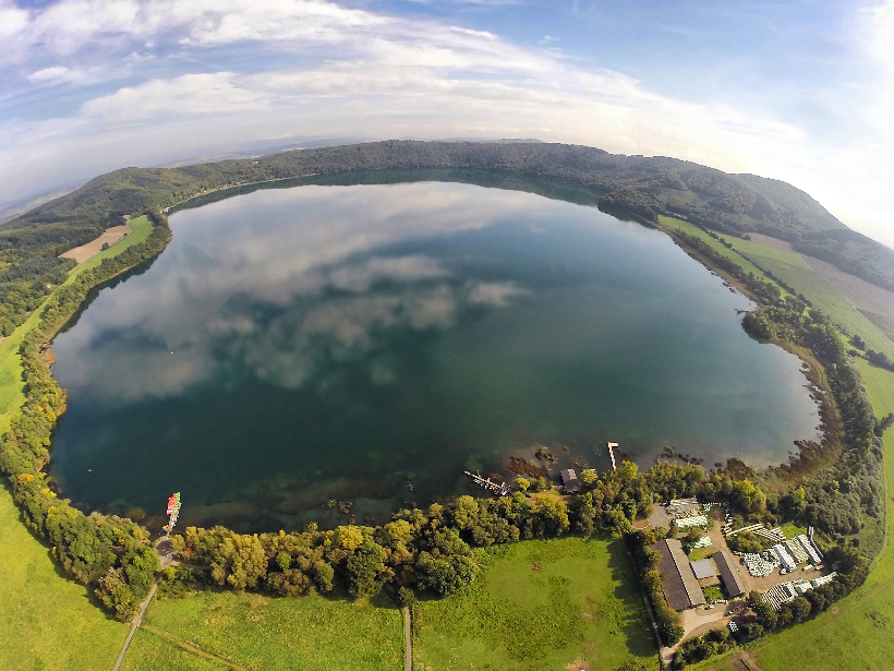
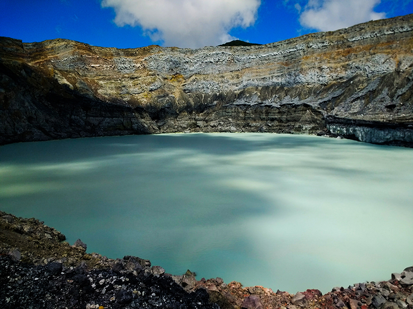
Messages in the Bubbles
Laacher See volcano is quiet, but gas bubbles rising through the overlying lake are a reminder of its potential hazard. Scientists took a close look at the bubbles to test eruption monitoring methods.
Posted inScience Updates
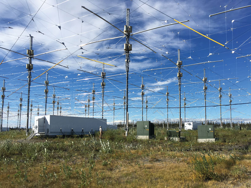
Returning Lightning Data to the Cloud
Scientists are assembling an online database with decades of low-frequency radio measurements collected worldwide to facilitate modern research about lightning, space weather, and more.
Posted inScience Updates
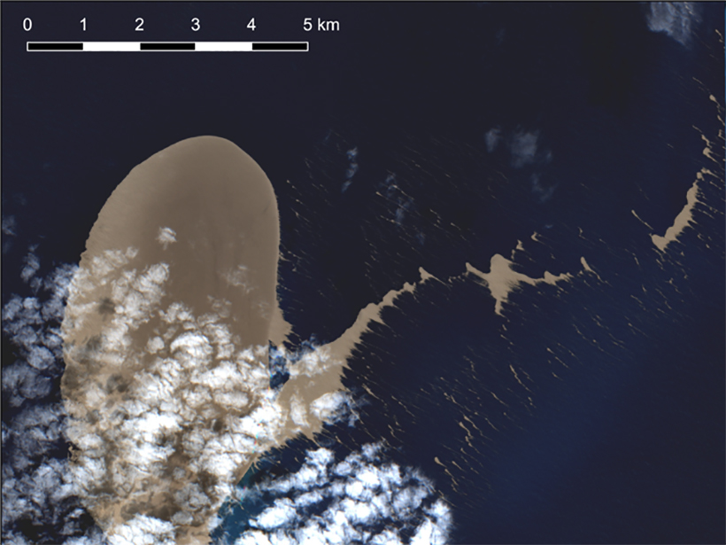
Satellite Sleuthing Detects Underwater Eruptions
Satellite data helped scientists locate the volcanic source of a pumice raft floating in the South Pacific Ocean, illustrating their promise in locating and monitoring undersea eruptions.
Posted inScience Updates
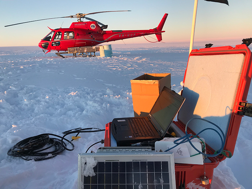
A Shared Resource for Studying Extreme Polar Environments
A new community pool of seismic instrumentation will facilitate and advance geologic and cryospheric research in Earth’s ice-covered environments.
Posted inScience Updates
Climate Data You Can Trust
Creating, curating, and developing the repository of climate data that underlies the U.S. National Climate Assessments requires the ongoing efforts of hundreds of experts.
Posted inScience Updates
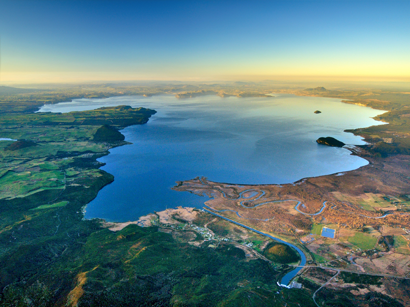
Implications of a Supervolcano’s Seismicity
Last year’s rumblings beneath New Zealand’s Taupō supervolcano, the site of Earth’s most recent supereruption, lend new urgency to research and outreach efforts in the region.
Posted inScience Updates
Microbial Influences on Subduction Zone Carbon Cycling
An innovative collaboration is investigating how geobiological processes alter fluxes of carbon and other materials between the deep Earth and the surface.

Posted inScience Updates
Searching for Mount Meager’s Geothermal Heart
A field expedition into the British Columbia wilderness involving helicopter drops, mountain and landslide traverses, and treacherous ice caves aimed to facilitate geothermal exploration in Canada.
Posted inScience Updates
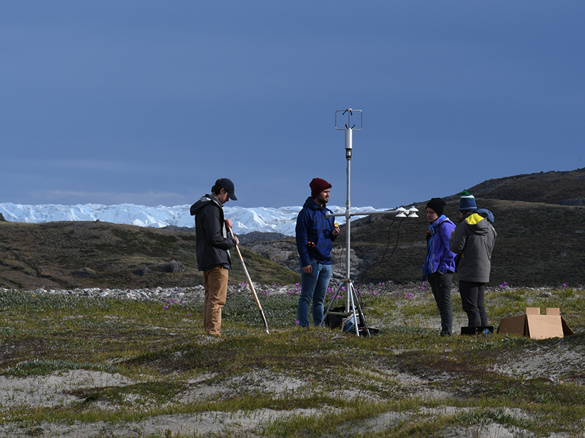
Seeing the Greenland Ice Sheet Through Students’ Eyes
A team of students and faculty advisers revisited the site of pioneering geosciences expeditions from the 1920s, looking to introduce young researchers to polar science.