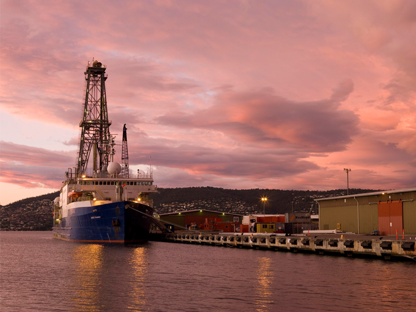
The first basin-wide compilation of seismic and geologic data shows that both margins experienced similar sedimentation patterns prior to the onset of Antarctic glaciation.
CC BY-NC-ND 2019
Posted inScience Updates
Teams Invited to Test Coastal Hyperspectral Imaging Algorithms
Hyperspectral Remote Sensing of Coastal and Inland Waters Webinar; 28 May 2019
Posted inScience Updates
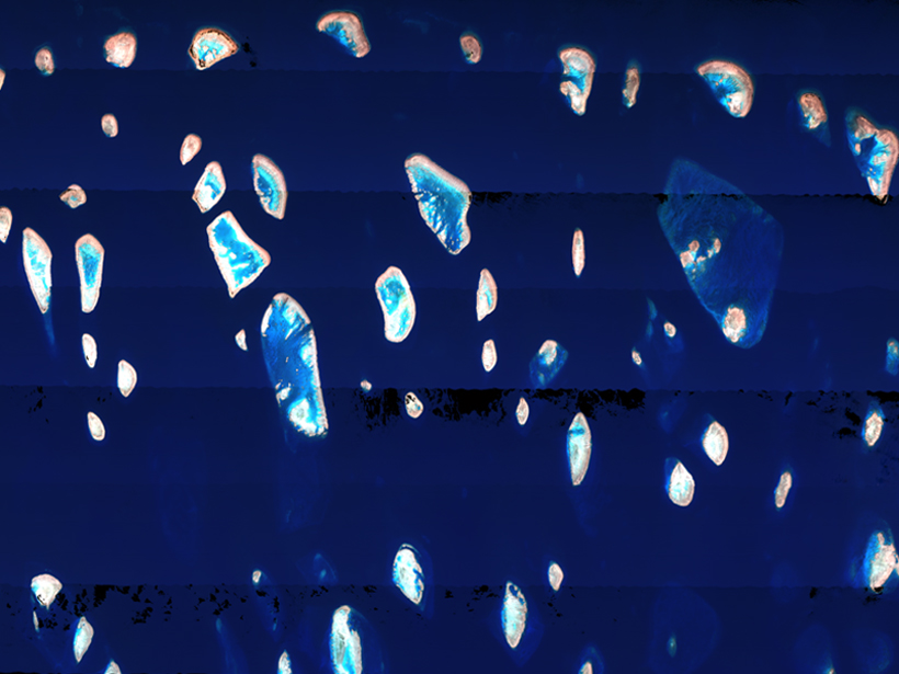
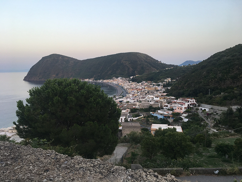
Seismic Sensors Probe Lipari’s Underground Plumbing
An international team of scientists installed a novel, dense network of 48 seismic sensors on the island of Lipari to investigate the active magma system underground.
Posted inResearch Spotlights
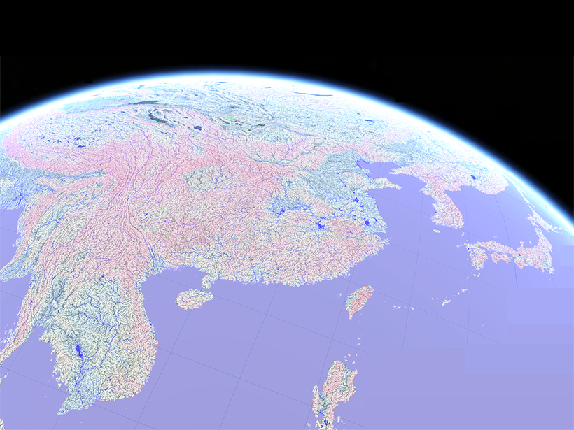
A More Accurate Global River Map
A new map of global river systems is based on crowdsourcing and the latest topography data sets.
Posted inEditors' Vox
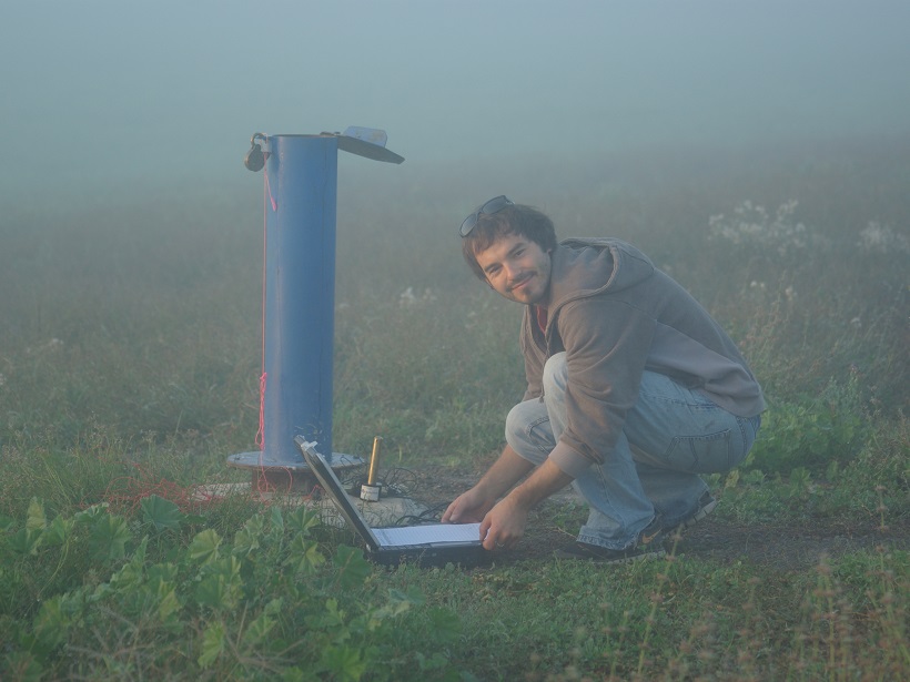
Unlocking a Treasure Trove for Subsurface Characterization
Earth and atmospheric tide signatures embedded in groundwater levels are a potential game changer in the monitoring of confined aquifers.

Posted inNews
The Mystery of the Moon’s Missing Metals
For decades, scientists have tried to figure out why the Moon has a thousand times less precious metals than Earth. Turns out the metals may not have been delivered after all.

Posted inNews
The Search for the Impact That Cratered Ancient Scotland
Great Britain’s largest impact crater likely lies in the Scottish Highlands. Scientists dispute whether it’s to the west or the east.
Posted inNews
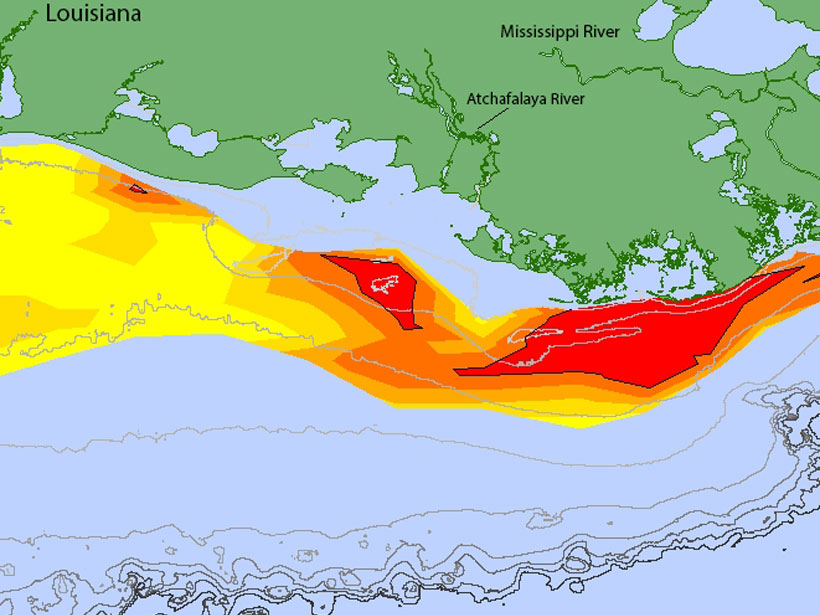
Gulf Dead Zone Looms Large in 2019
A new forecast predicts widespread hypoxia after a wet Midwest spring.
Posted inNews
Giant Planets and Brown Dwarfs Form in Different Ways
Once thought to be part of the same population, planets larger than Jupiter and “failed stars” likely grow via different mechanisms, the Gemini Planet Imager Exoplanet Survey has shown.

Posted inFeatures
Resurrecting Interest in a “Dead” Planet
New research suggests that the surface of Venus is busy, but it may take new missions to our “sibling” planet to confirm this.