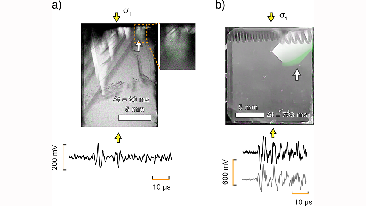
Simultaneous optical, mechanical, and acoustic measurements reveal that brittle microcracking and crystal-plastic twinning in calcite generate distinguishable acoustic signals.
Editors’ Highlights
Posted inEditors' Highlights
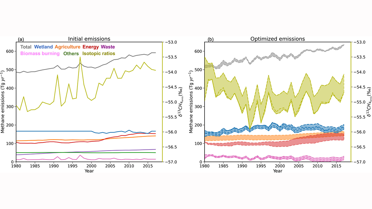
Cows, Coal, and Chemistry: The Role of Photochemistry in Methane Budget
Recent increases in atmospheric methane are a result of changing natural and manmade sources, climate, and other less-understood factors linked to its role in the atmosphere’s self-cleaning mechanisms.
Posted inEditors' Highlights
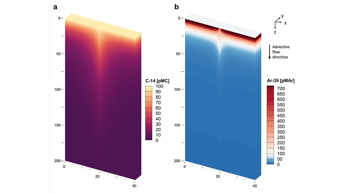
Calibrating the Clocks: Reconciling Groundwater Age from Two Isotopes
A new quantitative model corrects for tracer-based age biases from 39Ar and 14C isotopes leading to more accurate estimates of groundwater residence times.
Posted inEditors' Highlights
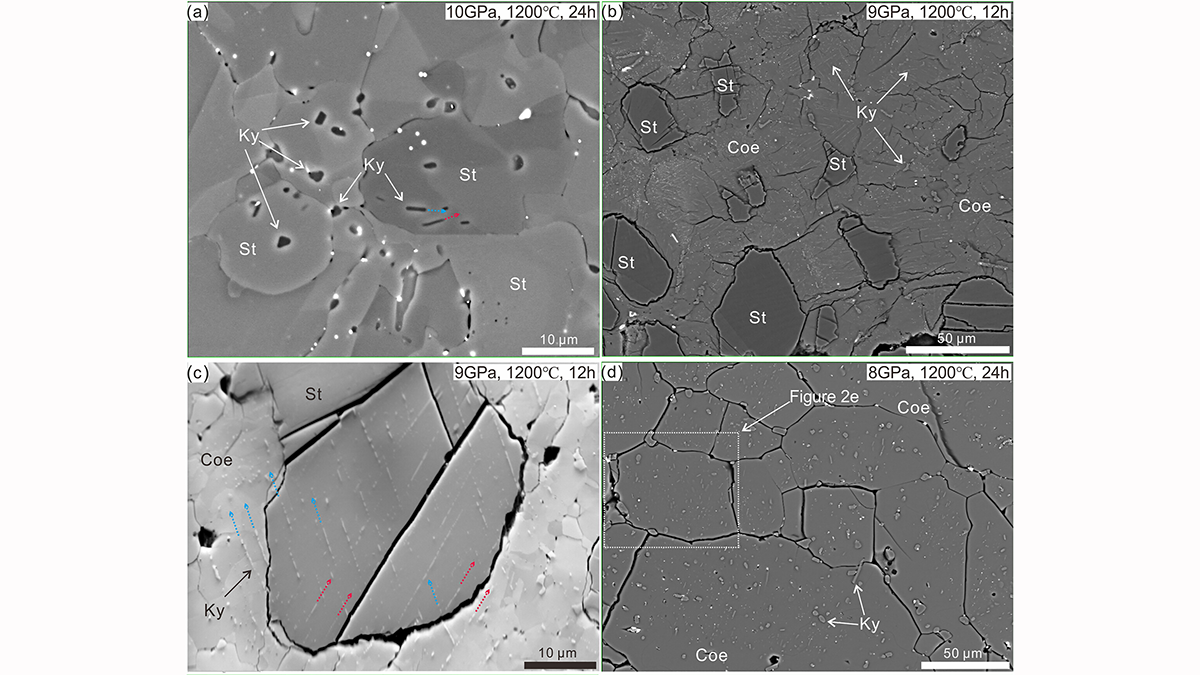
Kyanite Exsolution Reveals Ultra-Deep Subduction of Continents
Laboratory experiments provide the first experimental evidence that continental rocks can be subducted to depths greater than 300 kilometers and return to the surface.
Posted inEditors' Highlights
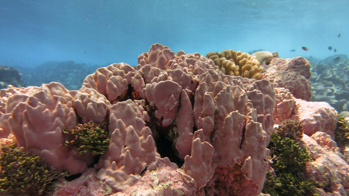
Coastal Coralline Algae Naturally Survive Persistent, Extreme Low pH
Time-series monitoring shows that a coastal coralline algae reef is naturally exposed to extreme low pH levels, suggesting potential adaptation of this biodiverse habitat to future ocean acidification.
Posted inEditors' Highlights
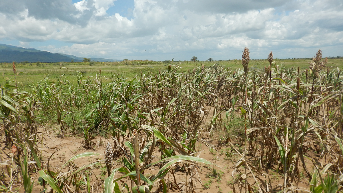
How Satellite Data Helped Avoid Hunger from Drought
Satellites detecting anomalies of the spectral reflectance of crops in Uganda successfully foretold imminent crop failure and automatically triggered timely governmental disaster relief.
Posted inEditors' Highlights
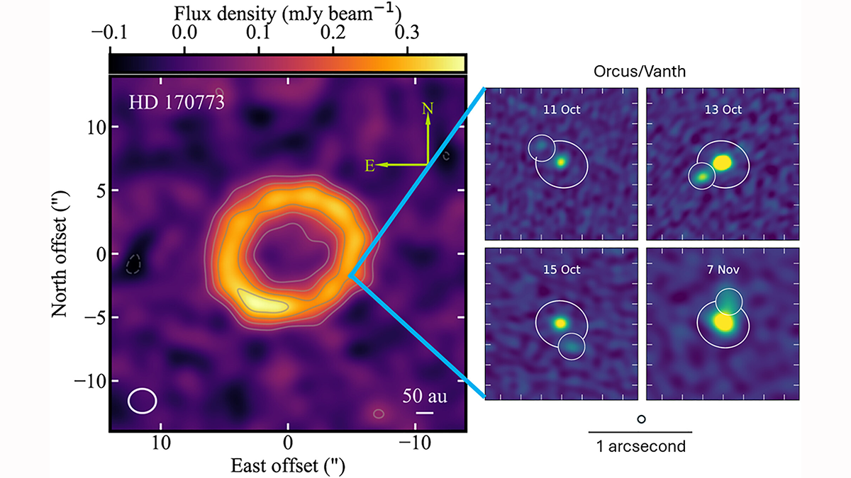
ALMA’s New View of the Solar System
High-resolution radio observations link the chemistry of local moons and comets to the birth environments of distant exoplanets.
Posted inEditors' Highlights
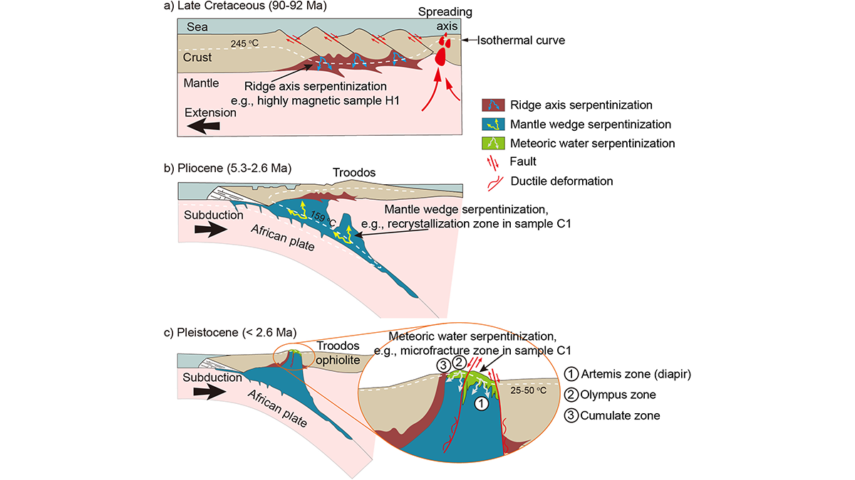
Detecting Remagnetization with Quantum Diamond Microscopy
Scientists reconstruct the magnetization timeline of serpentinized rocks from the Troodos ophiolite by investigating remanent magnetization-carrying structures with a Quantum Diamond Microscope.

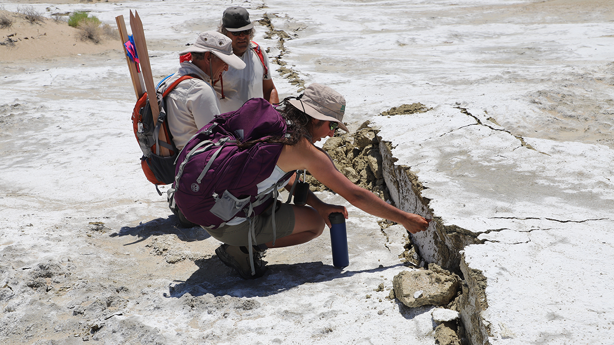
Posted inEditors' Highlights
Where the Tianshan Will Break Next: Strain, Slip, and Seismic Hazard
Geodetic strain and slip deficits reveal where the Tianshan is storing stress and which faults may generate the next major earthquakes in the region.
Posted inEditors' Highlights
Are We Really Seeing More Foreshocks with Enhanced Catalogs?
Different definitions and selection methods can lead to large differences in estimated foreshock rates; however, robust statistical method shows that foreshock rates are similar between standard and enhanced catalog.