• About
  • Sections
  • Topics
    • Climate
    • Earth Science
    • Oceans
    • Space & Planets
    • Health & Ecosystems
    • Culture & Policy
    • Education & Careers
    • Opinions
  • Projects
    • ENGAGE
    • Editors’ Highlights
    • Editors’ Vox
    • Eos en Español
    • Eos 简体中文版
    • Print Archive
  • Science Policy Tracker
  • Blogs
    • Research & Developments
    • The Landslide Blog
  • Newsletter
  • Submit to Eos
  • AGU.org
  • Career Center
  • Join AGU
  • Give to AGU
  • About
  • Sections
  • Topics
    • Climate
    • Earth Science
    • Oceans
    • Space & Planets
    • Health & Ecosystems
    • Culture & Policy
    • Education & Careers
    • Opinions
  • Projects
    • ENGAGE
    • Editors’ Highlights
    • Editors’ Vox
    • Eos en Español
    • Eos 简体中文版
    • Print Archive
  • Science Policy Tracker
  • Blogs
    • Research & Developments
    • The Landslide Blog
  • Newsletter
  • Submit to Eos
Skip to content
  • AGU.org
  • Career Center
  • Join AGU
  • Give to AGU
Eos

Eos

Science News by AGU

Support Eos
Sign Up for Newsletter
  • About
  • Sections
  • Topics
    • Climate
    • Earth Science
    • Oceans
    • Space & Planets
    • Health & Ecosystems
    • Culture & Policy
    • Education & Careers
    • Opinions
  • Projects
    • ENGAGE
    • Editors’ Highlights
    • Editors’ Vox
    • Eos en Español
    • Eos 简体中文版
    • Print Archive
  • Science Policy Tracker
  • Blogs
    • Research & Developments
    • The Landslide Blog
  • Newsletter
  • Submit to Eos

remote sensing

Posted inScience Updates

Urbanization Affects Air and Water in Italy's Po Plain

by M. Masetti, S. V. Nghiem, A. Sorichetta, S. Stevenazzi, P. Fabbri, M. Pola, M. Filippini and G. R. Brakenridge 23 October 201531 May 2022

Satellite and ground-based measurements show a correlation between urban growth and increased levels of pollutants.

Posted inResearch Spotlights

Night Lights Illuminate Human Presence near Rivers

Sarah Stanley, Science Writer by Sarah Stanley 20 October 201519 October 2021

Nocturnal satellite imagery and other fine-scale data could improve global water resources management.

Posted inOpinions

Data for All: Using Satellite Observations for Social Good

by F. Hossain 14 October 201527 July 2022

The satellite and science communities must engage with stakeholders to identify priorities and capabilities, enabling the most beneficial use of abundant satellite sensing data.

Posted inScience Updates

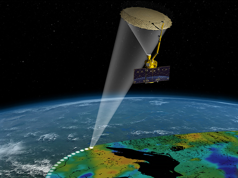
Satellite Data for Water Resources Management

by J. D. Bolten, Christine Lee and P. Houser 28 September 20153 March 2023

2015 NASA Applied Sciences Program, Water Resources Team Meeting; College Park, Md., 3–4 March 2015

Posted inResearch Spotlights

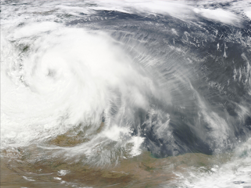
Cool Downdrafts in Large Thunderstorms Captured by Satellite

by David Shultz 4 September 20156 March 2023

Orbiting scatterometers can reveal patterns of cool air in mesoscale convective systems.

Posted inNews

Reduced Middle East Air Pollution Linked to Societal Disruption

JoAnna Wendel, freelance science writer and illustrator by JoAnna Wendel 24 August 20157 March 2023

Invasions, armed conflict, sanctions, and economic distress correlate with cleaner air in high-resolution satellite data that reveal air quality at the individual city level.

Posted inResearch Spotlights

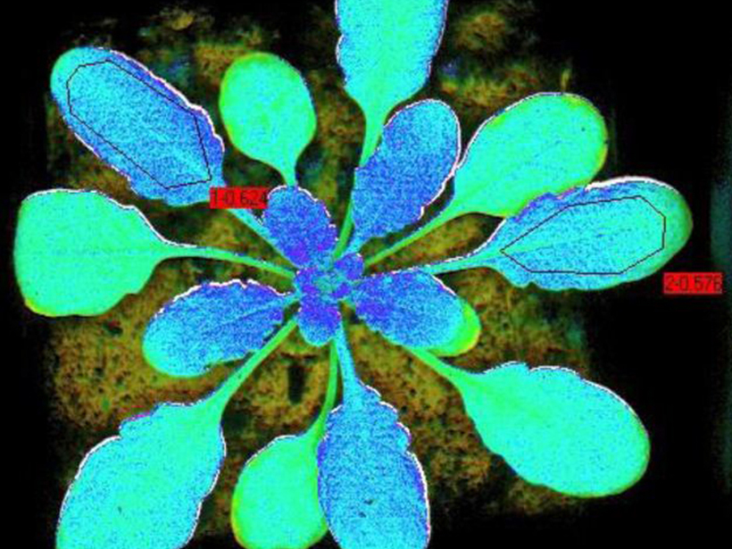
Airborne Sensor Can Track Photosynthesis Efficiency

by C. Palmer 7 August 201531 March 2023

Remote estimation of fluorescence emitted by plants can indicate variations in photosynthesis performance.

Posted inResearch Spotlights

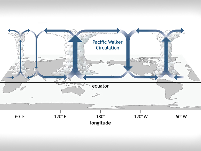
Rethinking How Tropical Convection Works

by C. Minnehan 17 July 201510 December 2022

Researchers look at previous Walker circulation models and ask, Does damping truly matter?

Posted inResearch Spotlights

Amazon Rain Forest Nourished by African Dust

by Terri Cook 22 June 201529 April 2022

New satellite data highlight the important role African dust plays in maintaining the rain forest's long-term health.

Posted inResearch Spotlights

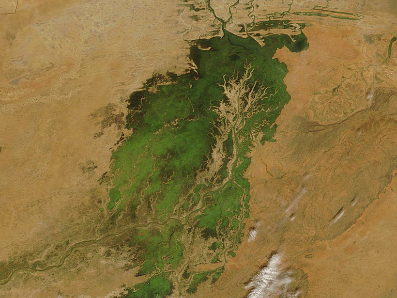
Satellite Measurements May Help Real-Time Water Management

by Terri Cook 9 June 201530 March 2023

Upper Niger River study shows that satellite altimetry could help resource managers optimize reservoir releases even on ungauged rivers.

Posts pagination

Newer posts 1 … 32 33 34 35 36 37 Older posts
A view of a Washington, D.C., skyline from the Potomac River at night. The Lincoln Memorial (at left) and the Washington Monument (at right) are lit against a purple sky. Over the water of the Potomac appear the text “#AGU24 coverage from Eos.”

Features from AGU Publications

Research Spotlights

Machine Learning Simulates 1,000 Years of Climate

27 August 202527 August 2025
Editors' Highlights

Quantifying Predictability of the Middle Atmosphere

5 September 20255 September 2025
Editors' Vox

Experienced Researcher Book Publishing: Sharing Deep Expertise

3 September 202526 August 2025
Eos logo at left; AGU logo at right

About Eos
ENGAGE
Awards
Contact

Advertise
Submit
Career Center
Sitemap

© 2025 American Geophysical Union. All rights reserved Powered by Newspack