• About
  • Sections
  • Topics
    • Climate
    • Earth Science
    • Oceans
    • Space & Planets
    • Health & Ecosystems
    • Culture & Policy
    • Education & Careers
    • Opinions
  • Projects
    • Postcards From the Field
    • ENGAGE
    • Editors’ Highlights
    • Editors’ Vox
    • Eos en Español
    • Eos 简体中文版
    • Print Archive: 2015–2025
  • Science Policy Tracker
  • Blogs
    • Research & Developments
    • The Landslide Blog
  • Newsletter
  • Submit to Eos
  • AGU.org
  • Career Center
  • Join AGU
  • Give to AGU
  • About
  • Sections
  • Topics
    • Climate
    • Earth Science
    • Oceans
    • Space & Planets
    • Health & Ecosystems
    • Culture & Policy
    • Education & Careers
    • Opinions
  • Projects
    • Postcards From the Field
    • ENGAGE
    • Editors’ Highlights
    • Editors’ Vox
    • Eos en Español
    • Eos 简体中文版
    • Print Archive: 2015–2025
  • Science Policy Tracker
  • Blogs
    • Research & Developments
    • The Landslide Blog
  • Newsletter
  • Submit to Eos
Skip to content
  • AGU.org
  • Career Center
  • Join AGU
  • Give to AGU
Eos

Eos

Science News by AGU

Support Eos
Sign Up for Newsletter
  • About
  • Sections
  • Topics
    • Climate
    • Earth Science
    • Oceans
    • Space & Planets
    • Health & Ecosystems
    • Culture & Policy
    • Education & Careers
    • Opinions
  • Projects
    • Postcards From the Field
    • ENGAGE
    • Editors’ Highlights
    • Editors’ Vox
    • Eos en Español
    • Eos 简体中文版
    • Print Archive: 2015–2025
  • Science Policy Tracker
  • Blogs
    • Research & Developments
    • The Landslide Blog
  • Newsletter
  • Submit to Eos

anisotropy

Map of the study area in western India showing a network of seismic recording stations
Posted inEditors' Highlights

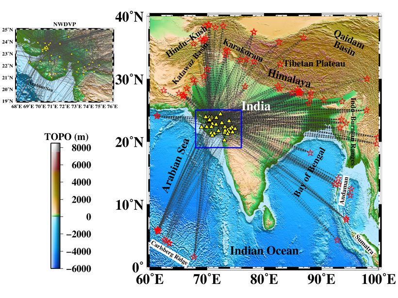
Hunting the Source of Deccan Traps Volcanism Using Seismic Waves

by Fiona Darbyshire 1 March 20218 July 2024

Seismic velocity patterns beneath the Deccan Traps region in western India reveal its volcanic history.

Figures showing modeling of fault related anisotropy
Posted inEditors' Highlights

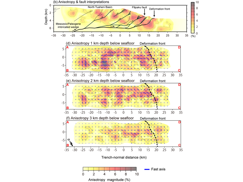
Fault Related Anisotropy in the Hikurangi Subduction Zone

by A. Becel 13 January 20218 July 2024

A new study provides the first high-resolution three-dimensional anisotropic P-wave velocity model of the shallow part of the Northern Hikurangi subduction zone offshore New Zealand.

Posted inEditors' Highlights

Seismic Anisotropy Due to a Compositionally Layered Mantle

by Bjarne S. G. Almqvist 8 March 20198 July 2024

Investigating the role of layered rocks and compositional banding on mineral scale in generating seismic anisotropy in the mantle.

Researchers examine how mantle upwelling under oceanic transform faults stabilizes these boundaries.
Posted inResearch Spotlights

Widespread Mantle Upwelling Beneath Oceanic Transform Faults

by Terri Cook 13 March 20188 July 2024

A global characterization of mantle flow patterns beneath active oceanic transforms suggests pervasive upwelling stabilizes divergent plate boundaries by warming and weakening these enigmatic features.

A new study uses mathematical modeling to understand the movement of Earth’s crust
Posted inResearch Spotlights

Measuring Earth’s Elasticity

by E. Underwood 2 October 20178 July 2024

A new study illuminates how crustal rocks break and stretch.

Japanese-islands-earthquake-tsunami-volcanic-eruption-lithospheric-plate-convergence
Posted inResearch Spotlights

Mapping the Movement of Energy Under Japan

Leah Crane by L. Crane 1 August 20168 July 2024

New research on the energy waves caused by earthquakes provides the most detailed map to date of the subduction zone beneath Japan.

Posted inResearch Spotlights

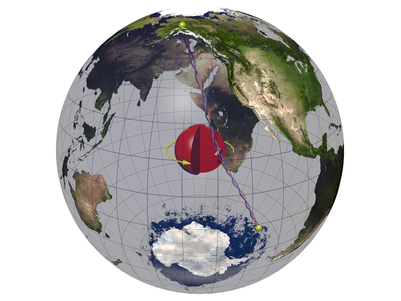
The Enigmatic Core Properties of the Inner Earth

by S. Palus 28 October 20158 July 2024

A new study explores the possibility of cubic iron alloy structure at our planet's core.

Posted inResearch Spotlights

A Modified Technique to Remotely Detect Subsurface Melt

by C. Schultz 5 March 20158 July 2024

Adapting a much-used analytical method to consider anisotropy opens up the approach to new uses.

Posts pagination

Newer posts 1 2
A view of a bridge, with the New Orleans skyline visible in the distance between the bridge and the water. A purple tint, a teal curved line representing a river, and the text “#AGU25 coverage from Eos” overlie the photo.

Features from AGU Publications

Research Spotlights

Denitrification Looks Different in Rivers Versus Streams

16 January 202616 January 2026
Editors' Highlights

ALMA’s New View of the Solar System

16 January 202616 January 2026
Editors' Vox

Bridging the Gap: Transforming Reliable Climate Data into Climate Policy

16 January 202616 January 2026
Eos logo at left; AGU logo at right

About Eos
ENGAGE
Awards
Contact

Advertise
Submit
Career Center
Sitemap

© 2026 American Geophysical Union. All rights reserved Powered by Newspack