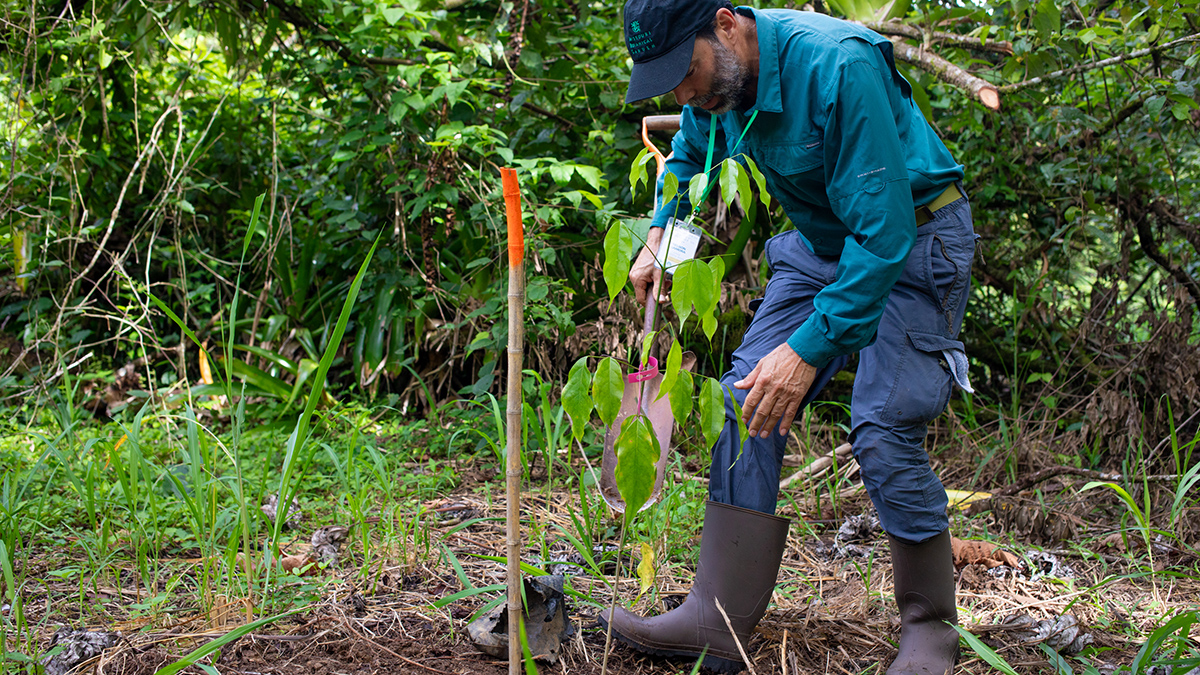
El 46% de las especies arbóreas de Mesoamérica se encuentran en peligro de extinción. Investigadores esperan que un nuevo estudio regional provea información acerca de estrategias de conservación específicas.
Central America

Posted inNews
First Species-Level Assessment Reveals Extinction Risk in Mesoamerica
Forty-six percent of tree species in Mesoamerica are threatened with extinction. Researchers hope a new regional study will inform targeted conservation strategies.

Posted inEditors' Highlights
Dual Tsunami Generation from Atmospheric and Oceanic Sources
The 2022 Tonga volcanic eruption generated waves that propagated across the Pacific Ocean. A new analysis of sea level measurements is used to dissect the difference in wave components from two sources.

Posted inResearch Spotlights
Los primeros eventos de deslizamiento lento observados en el sur de Costa Rica
Cinco eventos observados en la Península de Osa revelan nueva información sobre el papel que estos pequeños y lentos terremotos pueden desempeñar en la acumulación de tensión y riesgos de tsunami a lo largo de las zonas de subducción.

Posted inResearch Spotlights
The First Slow-Slip Events Seen off Southern Costa Rica
Five events observed off the Osa Peninsula shed new light on the role that these small, slow earthquakes can play in strain accumulation and tsunami hazards along subduction zones.
Posted inEditors' Vox
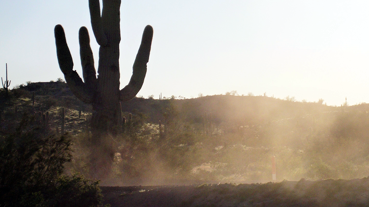
Danger in the Dust! The Hazards of Windblown Dust
Airborne dust not only causes disease, it also menaces transportation on land, sea, and air; disrupts renewable energy systems; transports pathogens and toxic substances; and poses many other hazards.

Posted inENGAGE, News
Harpy Eagles Concentrate Precious Nutrients in the Amazon
Amazon soils are usually low in the nutrients that plants covet, but harpy eagles can create local hot spots with their poop and prey.

Posted inNews
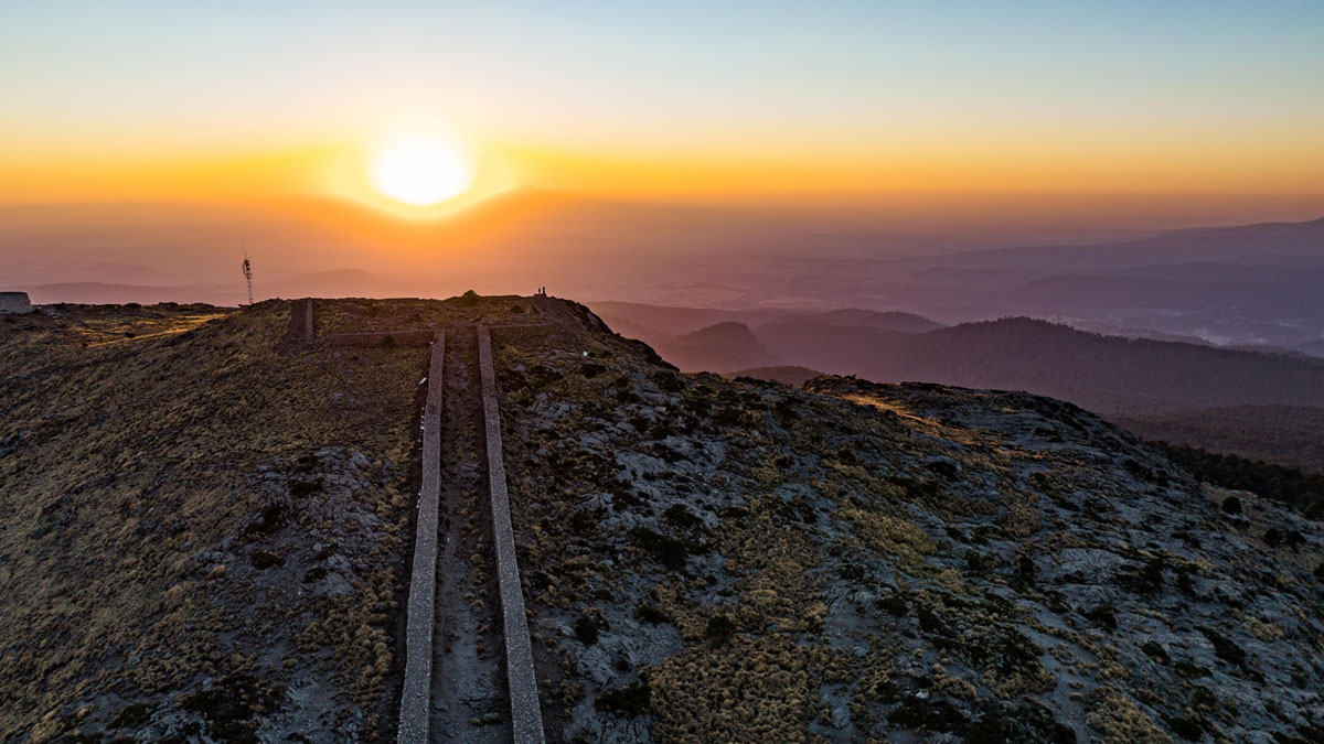
El papel central de la agricultura en el calendario de horizonte azteca
Los calendarios de horizonte fueron clave para medir el tiempo para las culturas pre-hispánicas de la cuenca del Valle de México. Un nuevo estudio sugiere que los calendarios se usaron para gestionar los ciclos agrícolas.
Posted inNews
Agriculture at the Center of the Aztec Horizon Calendar
Horizon calendars were a key part of time measurement for pre-Hispanic cultures in the Basin of Mexico. A new study suggests that calendars were used to manage the agricultural cycle.
Posted inScience Updates
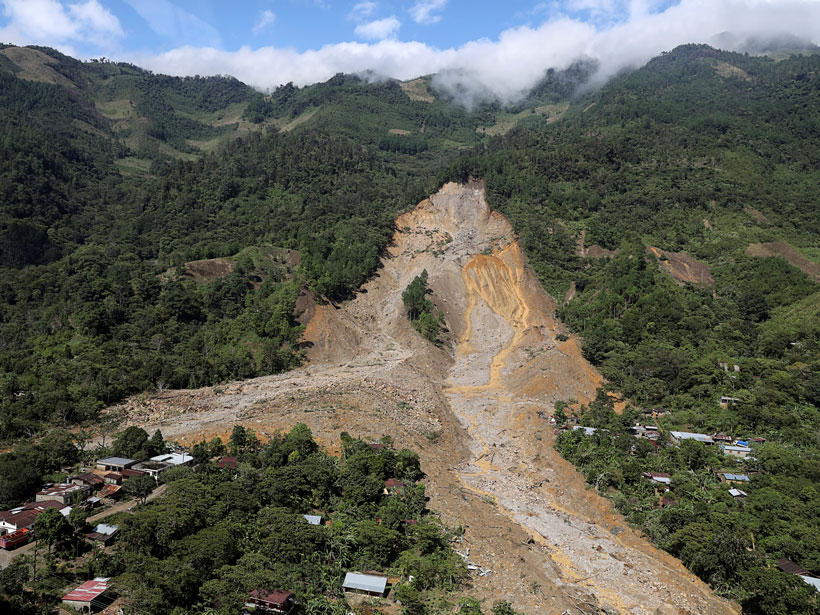
Satellites Support Disaster Response to Storm-Driven Landslides
Extreme precipitation can trigger deadly landslides. Satellite-based tools provide regional perspectives on landslide hazards, help assess risks in near-real time, and guide emergency responses.