A transdimensional, probabilistic approach is more flexible than traditional least squares fits and provides better handling of sharply varying slip distributions.
earthquakes

Posted inEditors' Highlights
Earthquake Rupture Solution is Up in the Air
Perhaps the most complex earthquake rupture ever studied is further constrained by signals from Earth’s ionosphere.
Posted inEditors' Highlights
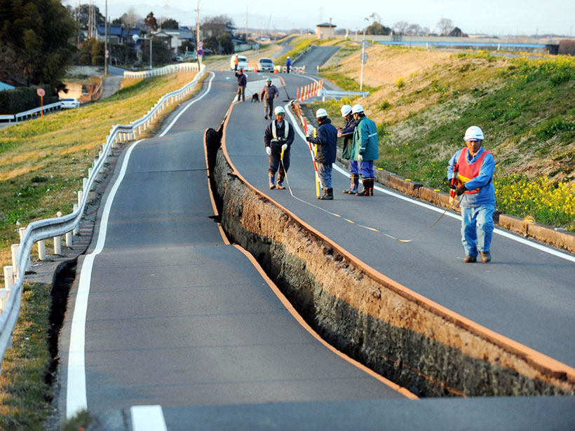
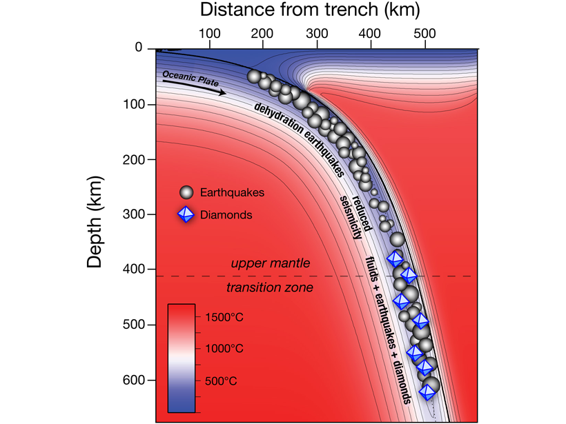
Diamonds Are at Fault
Deep-seated earthquakes in subduction zones are related to diamond formation.

Posted inNews
High School Junior Builds Cheap Earthquake Warning Device
The project exploring seismic noise during the coronavirus pandemic was fueled by Google searches and bathroom soldering sessions.
Posted inEditors' Highlights
Earthquake Rates Enhanced by Triggered Creep
Analysis of California earthquakes solidifies links between shaking due to remote earthquakes and increased local earthquake activity that persists for times longer than for regular aftershocks.
Posted inEditors' Highlights
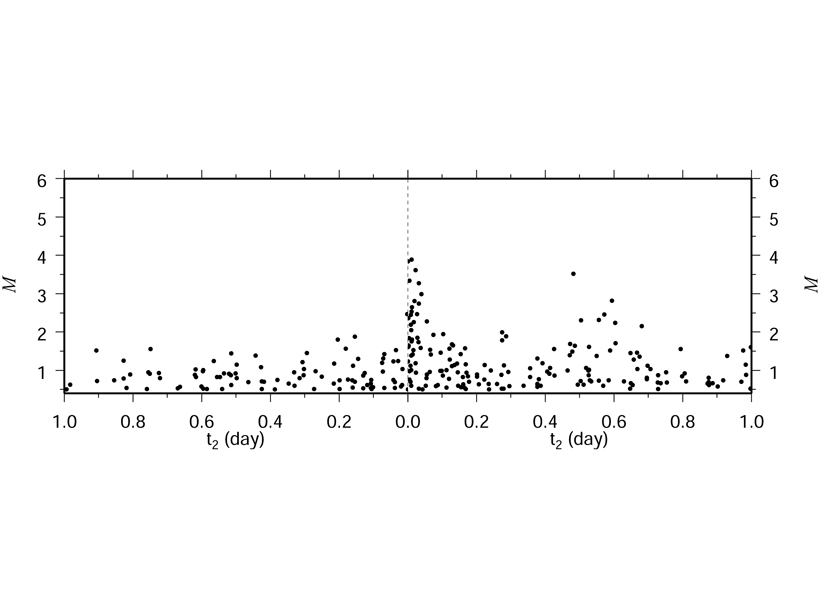
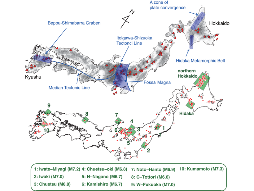
The First Systematic Search for Enervated Earthquakes
High quality data from Japan provides answers on where and when “enervated” earthquakes occur.
Posted inEditors' Highlights
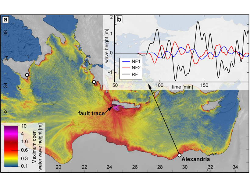
Was the AD 365 Mediterranean Earthquake Normal?
The great AD 365 earthquake at Crete has implied a locked Hellenic subduction zone that can produce more earthquakes to threaten Mediterranean coastlines. But what if wasn’t a subduction zone event?

Posted inNews
Earthquake Alerts Go Live in the Pacific Northwest
Oregon and Washington residents will receive an alert on their cell phones if they are in danger from an incoming quake.

Posted inNews
Ocean Sensors Record Rare Triple Tsunami near New Zealand
A new suite of DART buoys in the South Pacific Ocean spotted waves set in motion by three tsunamigenic earthquakes that occurred within hours of one another.

Posted inEditors' Highlights
Relating Seismicity and Volcano Eruptions
A global study suggests that volcanic eruption forecasting and detection may be improved by examining earthquake mechanisms and clustering in combination with individual volcano properties.