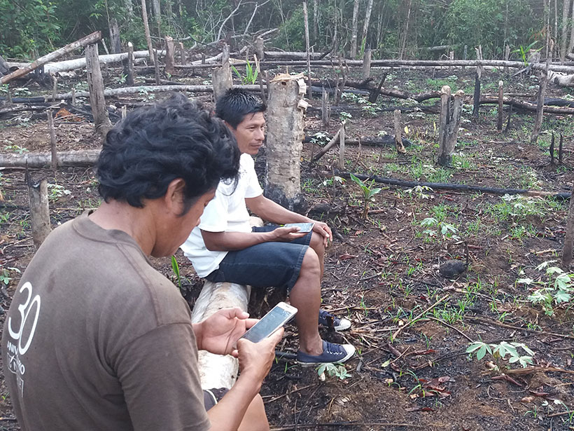
Satellite observations have long been used to detect deforestation, and a new study shows that giving Indigenous groups greater access to these data can improve response times and reduce tree cover loss.
Landsat
Posted inNews
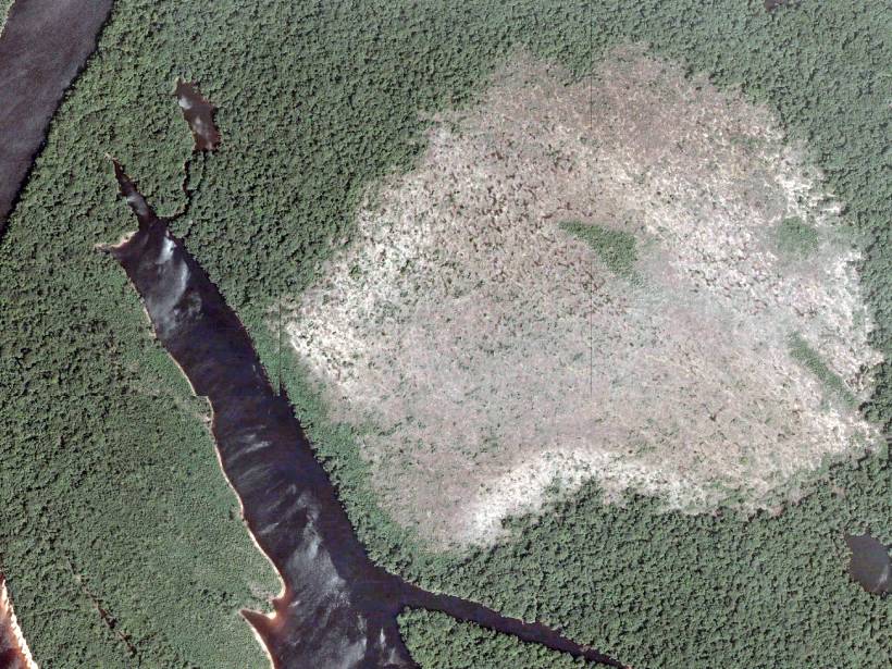
Amazon Forests Are Turning into Savannas
Floodplain forests have low resilience to repeated exposure to wildfires. As climate change increases the instances of fires, forests may transform to less productive grassland ecosystems.
Posted inEditors' Highlights
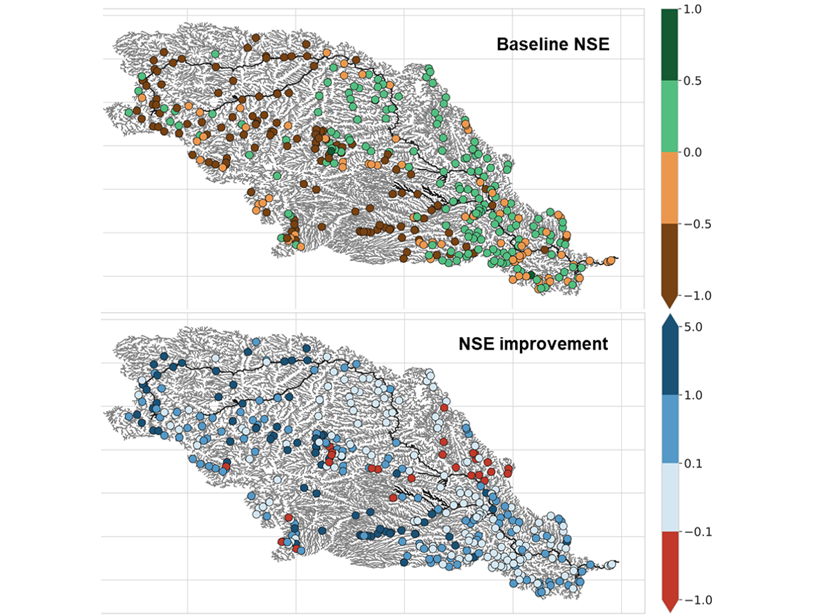
Gauging Ungauged River Basins with Smart Remote Sensing
A clever combination of hydrologic modelling and discharge estimates from the Landsat satellite provides good discharge estimates throughout the Missouri river basin.
Posted inFeatures
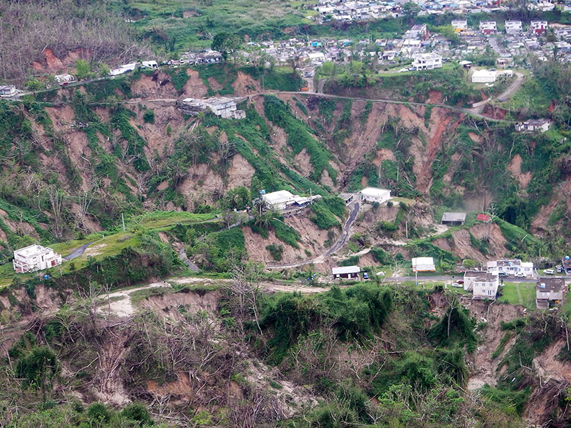
A Slippery Slope: Could Climate Change Lead to More Landslides?
Scientists investigate whether warming temperatures and changing rainfall patterns could be triggering more landslides in mountainous areas.
Posted inScience Updates
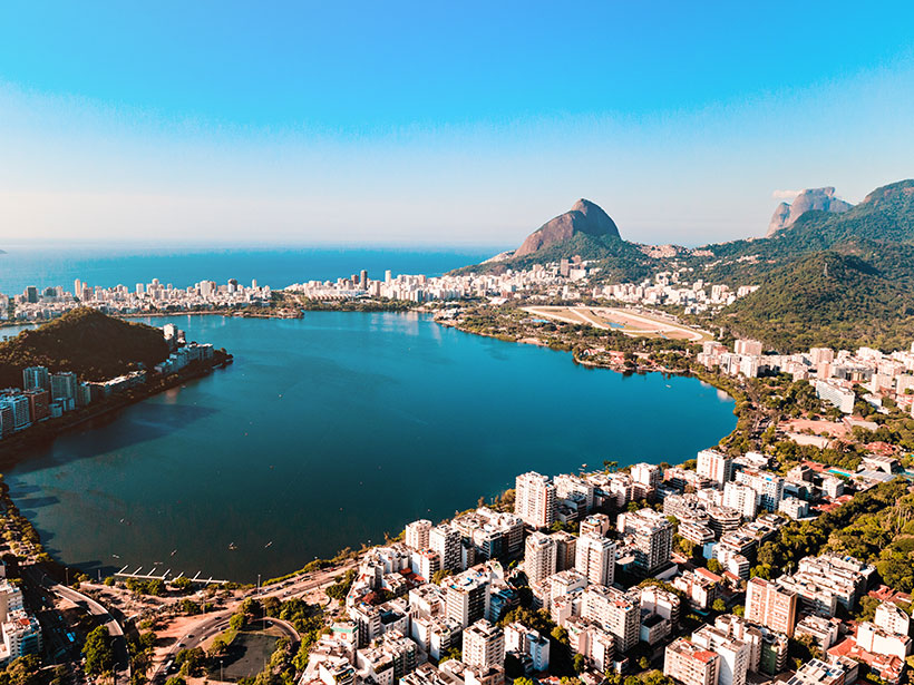
Earth Observations Inform Cities’ Operations and Planning
Rio de Janeiro, Brazil, and Chicago, Ill., are using NASA Earth observations to map, monitor, and forecast water and air quality, urban heat island effects, landslide risks, and more.
Posted inNews
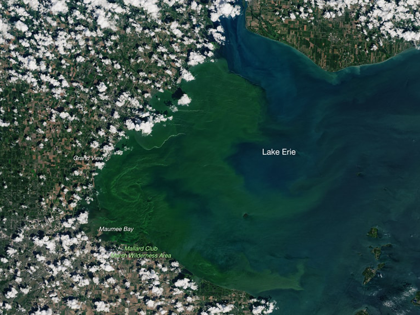
AquaSat Gives Water Quality Researchers New Eyes in the Sky
A new data set combining sample data and remote sensing could give scientists the power to make accurate predictions at a global scale.

Posted inNews
Varying Impact of Earthquake- and Monsoon-Induced Landslides
Using nearly 50 years of satellite data and records stretching back millennia, scientists determine the relative frequency—and the erosional power—of monsoon- and earthquake-induced landslides in Nepal.
Posted inNews
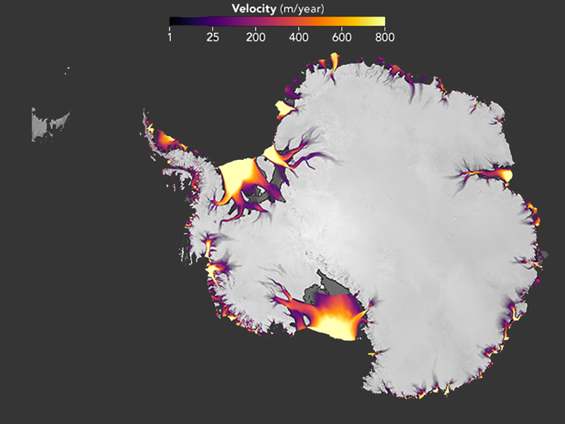
New Maps Highlight Antarctica’s Flowing Ice
The maps focus on surface ice velocity, showing how Antarctica’s frozen surface changed over a 7-year period.
Posted inScience Updates
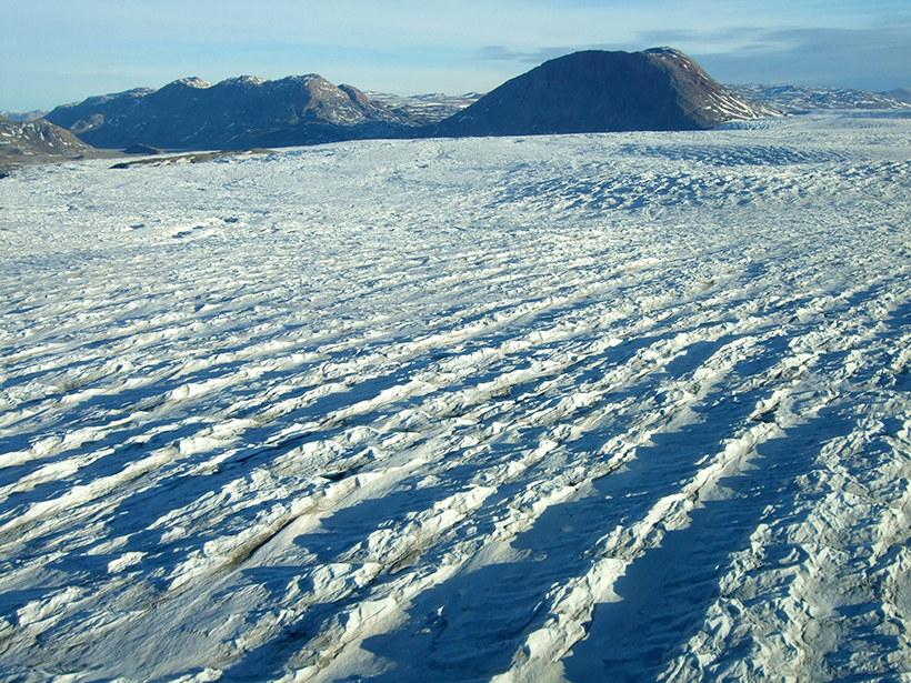
Using Landsat to Take the Long View on Greenland's Glaciers
A new web-based data portal gives scientists access to more than 40 years of satellite imagery, providing seasonal to long-term insights into outflows from Greenland's ice sheet.