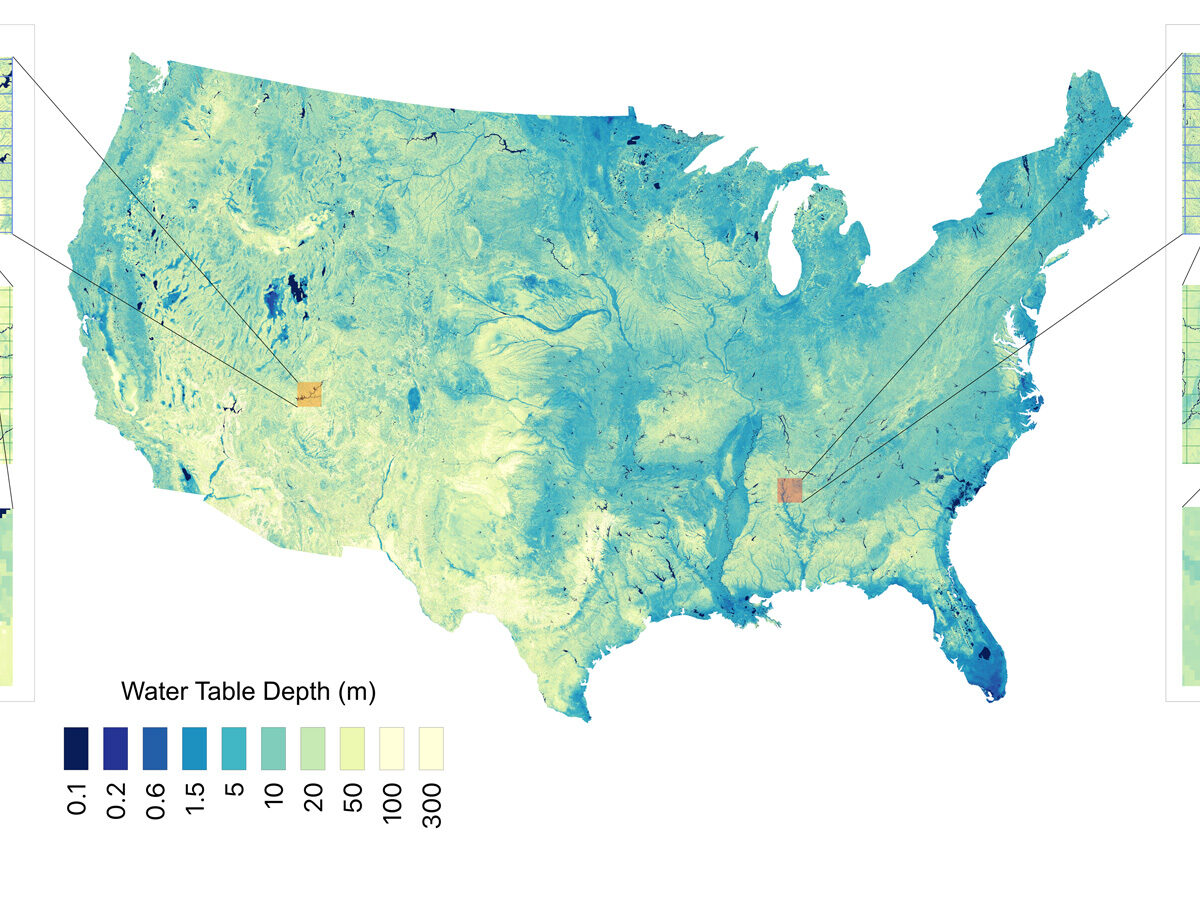
Researchers used 1 million data points and a machine learning algorithm to estimate groundwater stores with higher resolution than ever before.
mapping
Posted inFeatures
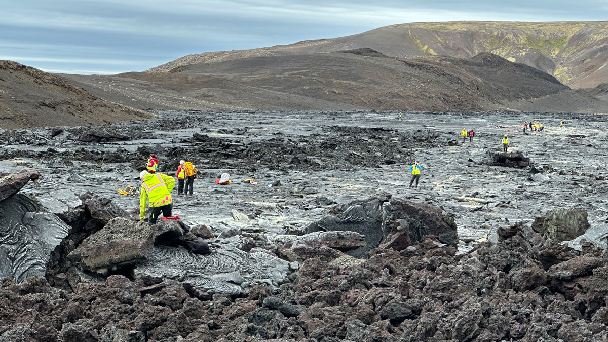
Discovering Venus on Iceland
Scientists trekked across Icelandic lava flows that served as stand-ins for Venus’s volcanic landscapes, testing tools and methods the upcoming VERITAS mission will use when it reaches the planet.
Posted inResearch Spotlights
Temperatures Are Rising, but What About Humidity?
Humid heat extremes are less frequently studied, but no less important, than those of dry heat.
Posted inNews
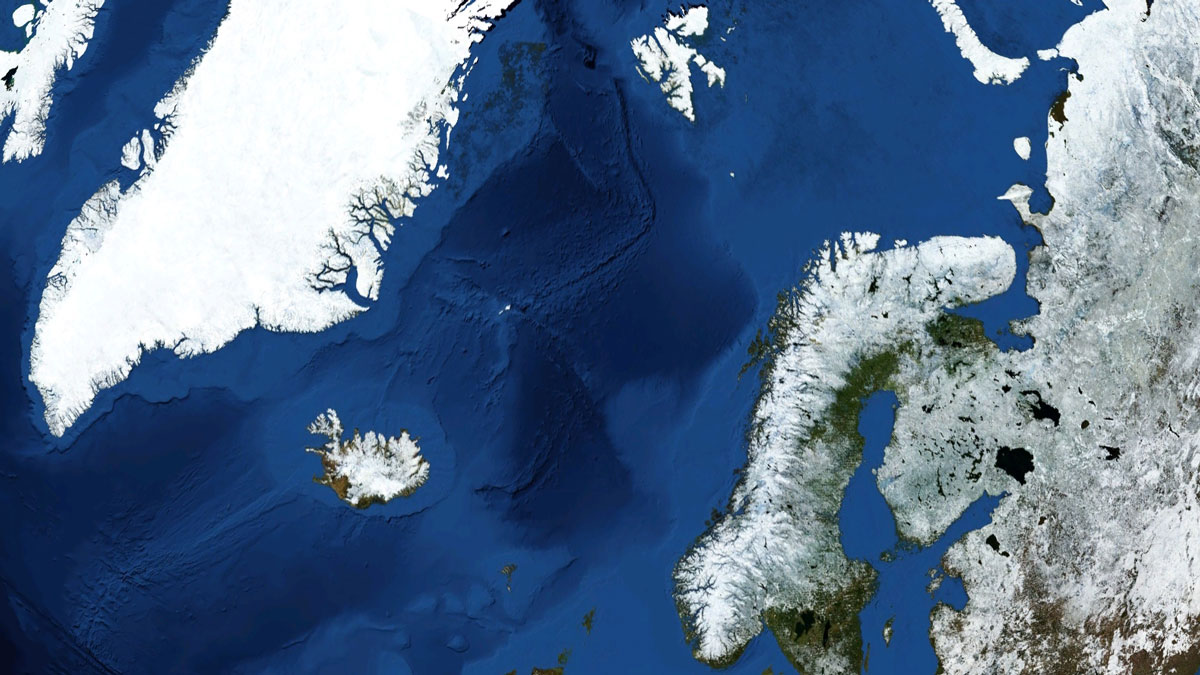
New Eyes on One of the Planet’s Largest Submarine Landslides
Researchers have mapped the ancient Stad Slide off the coast of Norway to better understand what triggered it, and the hunt is on for the tsunami it might have unleashed.
Posted inNews
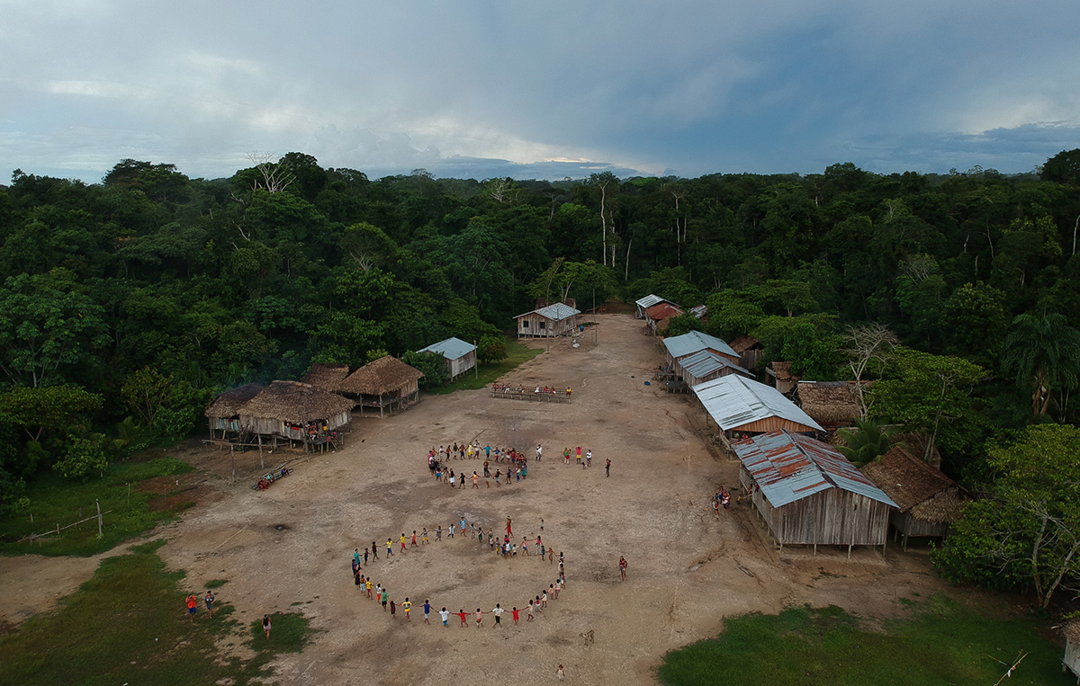
Fire Encroaches on One of the Amazon’s Most Pristine Indigenous Lands
New research shows how recurring wildfires in the buffer zones around Brazil’s Vale do Javari may undermine one of the Amazon’s last great refuges for isolated Indigenous peoples.
Posted inNews
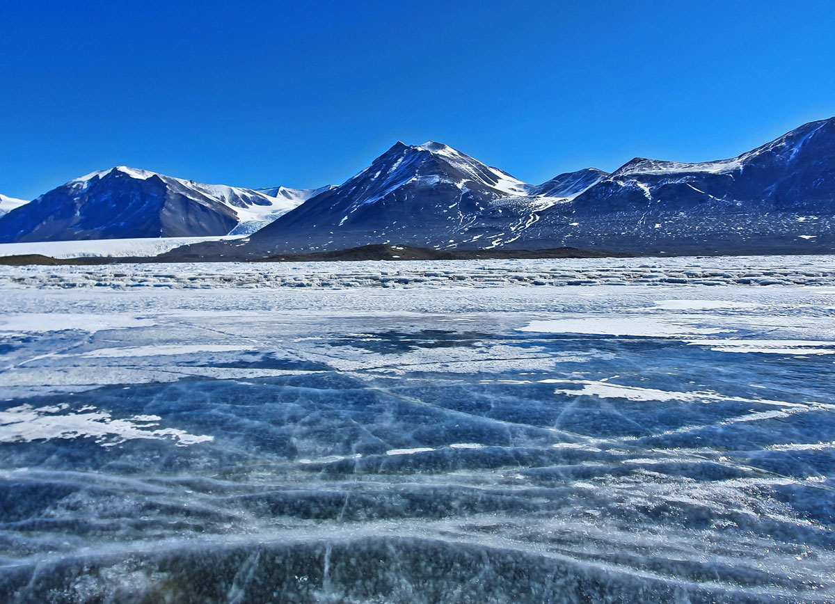
The Land Beneath Antarctica’s Ice Might Be Full of Water
Seismic surveys hint at the extent of a potential groundwater system in the White Continent.
Posted inNews
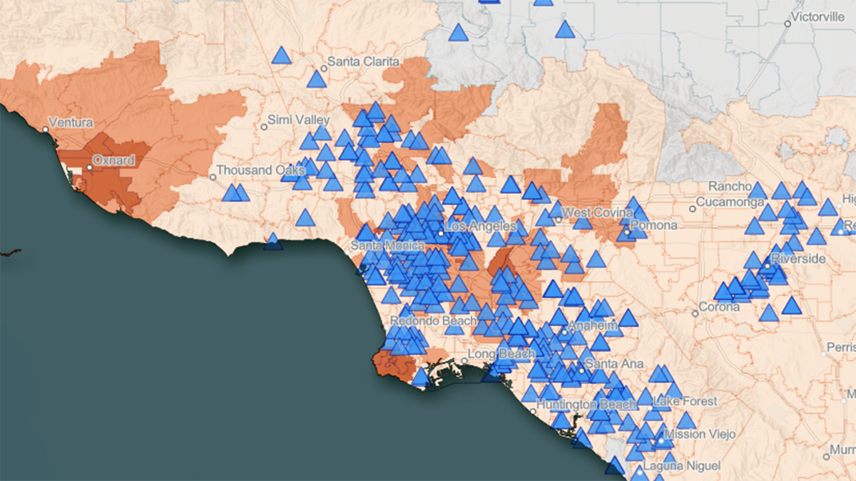
New Tool Maps the Overlap of Heat and Health in California
CalHeatScore creates heat wave warnings for every zip code in California, using temperature data, socioeconomic indicators, and the history of emergency room visits, to predict heat-related health risk.

Posted inNews
Martian Dust Devils Reveal Dynamic Surface Winds
A new wind map covering the whole of Mars includes some of the fastest winds ever detected on the Red Planet.
Posted inResearch Spotlights
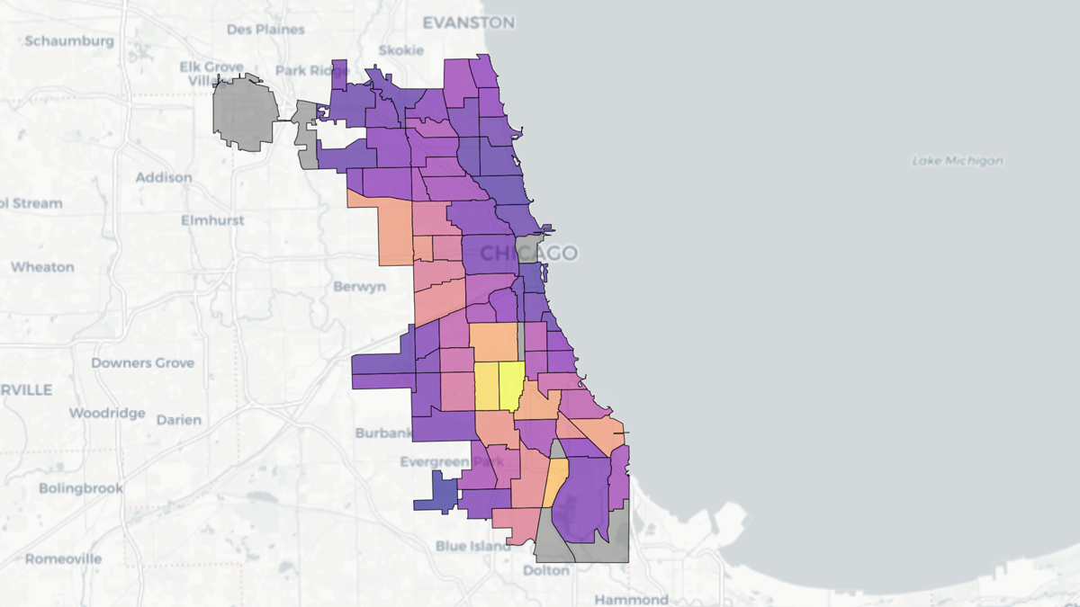
Chicago Soil Maps Childhood Lead Exposure Risk
Researchers combined soil measurements and public health data to identify areas where children may be exposed to unsafe levels of lead in the dirt.
Posted inNews
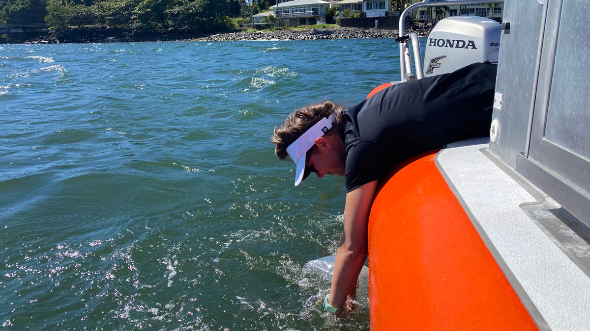
Pinpointing Sewage Seeps in Hawaii
Cesspools and septic systems, as well as coastal development, put Hawaiian coastal waters at risk of contamination.