Scientists leveraged a global camera network and doorbell cameras to track dozens of meteorites to their asteroid families.
mapping
Posted inNews
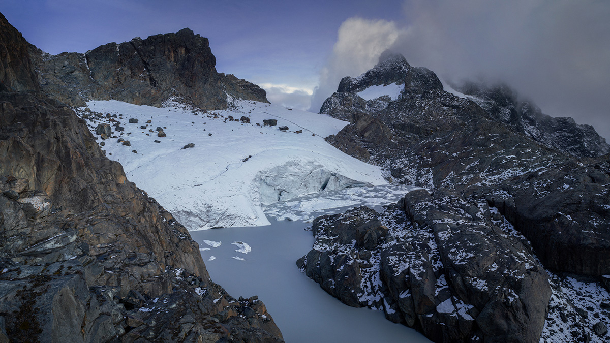
A New 3D Map Shows Precipitous Decline of Ugandan Glaciers
A team of dozens spent weeks in the Rwenzori Mountains capturing drone photography, GPS coordinates, and ground-penetrating radar data to document glacial retreat.
Posted inFeatures
Cómo pueden los vulcanólogos mejorar la resiliencia urbana al cambio climático
Las estrategias pensadas para ciudades enteras para hacer frente al cambio climático pueden beneficiarse de los conocimientos de los vulcanólogos, que llevan mucho tiempo adaptando la información y la comunicación sobre riesgos a las comunidades locales.
Posted inNews
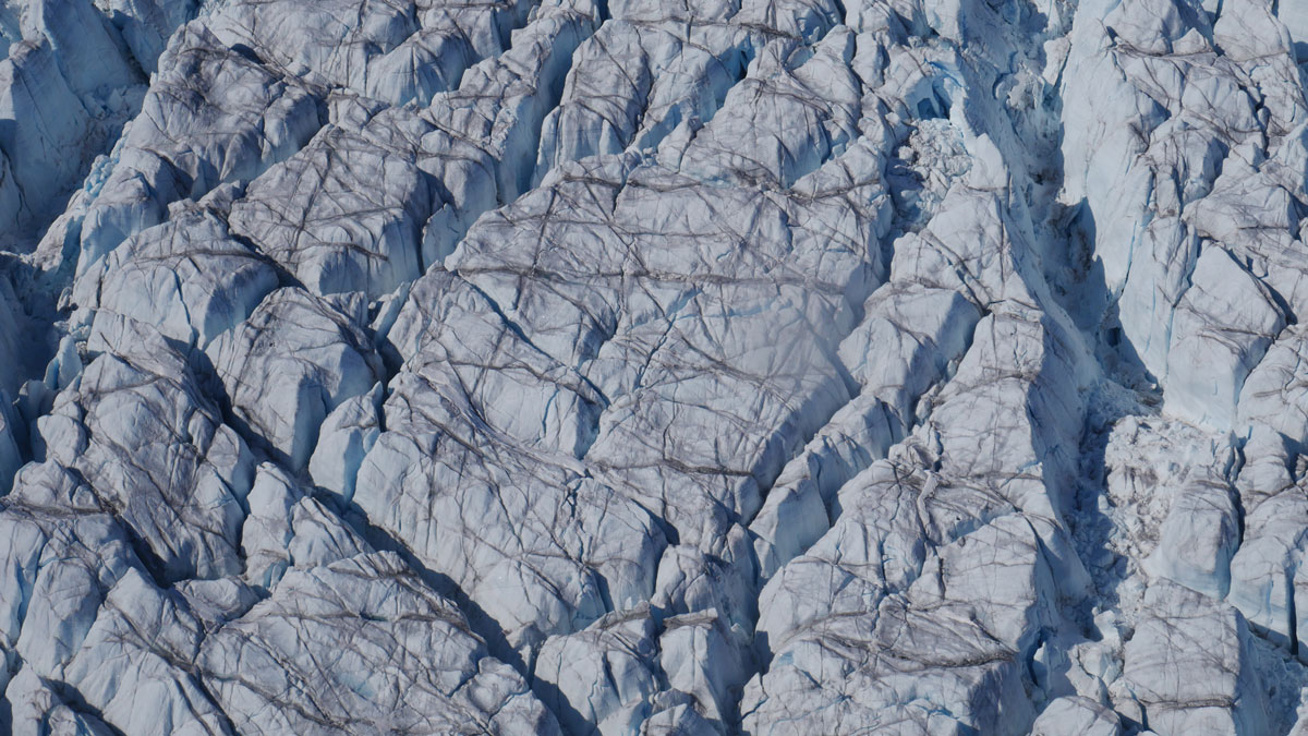
Crevasses on the Greenland Ice Sheet Are Growing
High-resolution 3D maps show crevasse volume is increasing across most of the Greenland Ice Sheet as it accelerates toward the ocean, which could affect future ice loss and sea level rise.
Posted inNews
Where the Wetlands Are
Researchers have crafted the most comprehensive map yet of Europe’s wetlands.
Posted inScience Updates
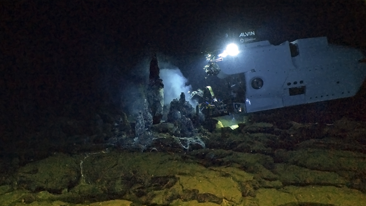
An Upgraded Alvin Puts New Ocean Depths Within Reach
The newly retooled submersible, which has already returned fascinating new findings from Earth’s watery depths, is opening more of the deep ocean to direct human exploration.
Posted inNews
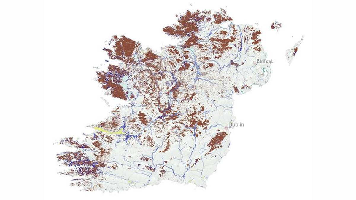
Mobile Bay Has More Branching Brooks Than Shown on Federal Maps
A more accurate charting of the full extent of stream networks will help land managers better protect U.S. creeks and rivers.

Posted inNews
Satellite Measurements Make Major Seafloor Map Improvements
Though ship-based sounding has mapped some areas of the ocean floor in higher resolution, researchers have used SWOT data to create a detailed new map of the seafloor, including thousands of previously undetected small seamounts.

Posted inFeatures
How Volcanologists Can Improve Urban Climate Resilience
City-level strategies to cope with climate change can benefit from the insights of volcano scientists, who have long customized hazard information and communications for local communities.
Posted inEditors' Highlights
Improvements to Measuring the Ups and Downs of the Landscape
If you are a jazz fan, you may be familiar with Ella Fitzgerald singing ‘How deep is the ocean, how high is the sky’. Using data from the Shuttle Radar Topography Mission we now know how high the land really is.