
A field expedition into the British Columbia wilderness involving helicopter drops, mountain and landslide traverses, and treacherous ice caves aimed to facilitate geothermal exploration in Canada.
North America

Posted inNews
Remote Landslide Puts Fraser River Salmon on Shaky Ground
An alliance of First Nations, provincial, and federal leaders worked with scientists, engineers, and emergency responders to rescue critical salmon stocks in western Canada.
Posted inNews
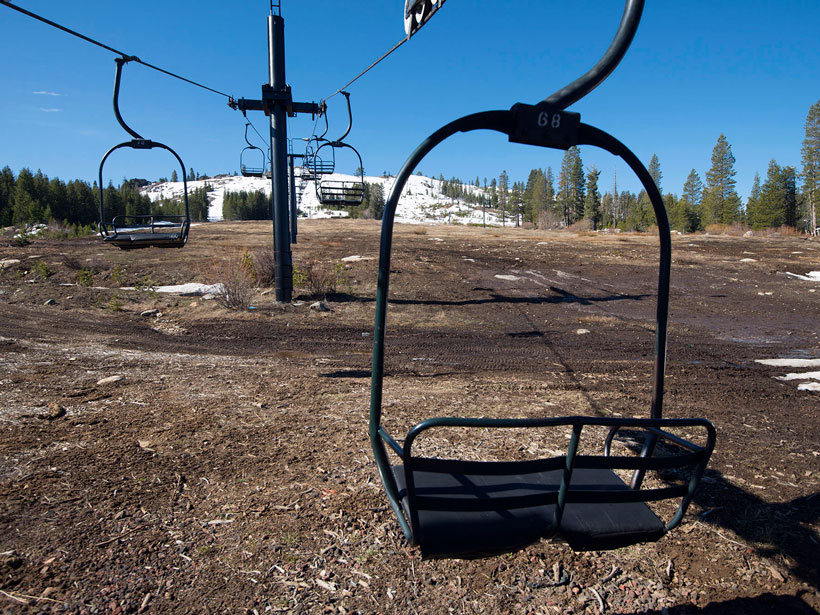
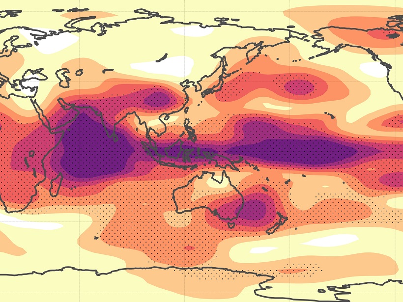
Here’s What Your Favorite Ski Resort May Look Like in 2085
Ski seasons at many of North America’s western resorts might melt away by 2085 because of warming temperatures.
Posted inEditors' Highlights
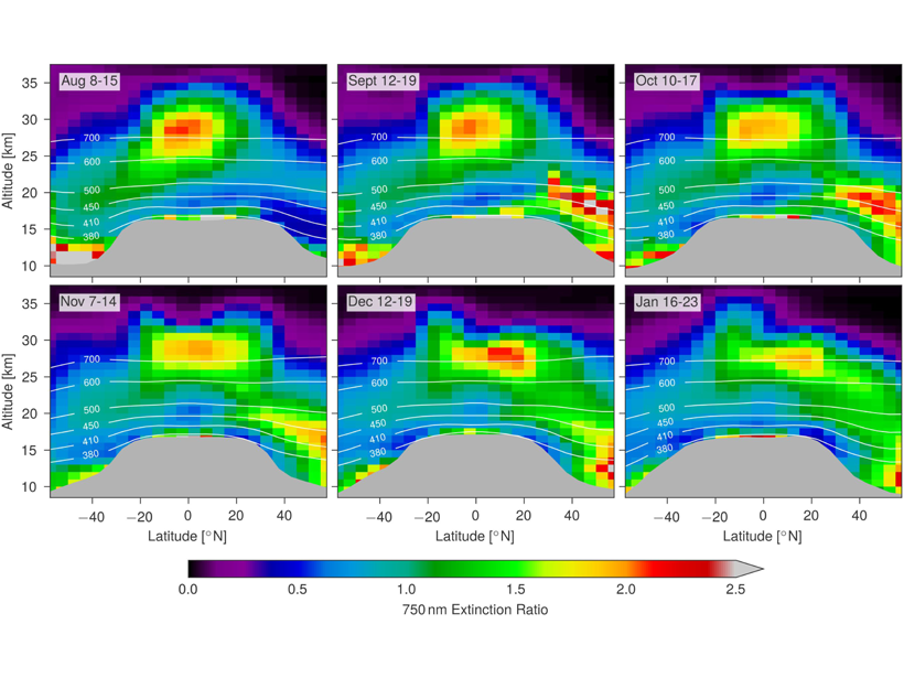
Satellite Measurements of Stratospheric Forest Fire Smoke
Intense boreal forest fires in August 2017 caused smoke plumes that reached record levels in the stratosphere; satellite measurements show that the effects rivaled a moderate volcanic eruption.
Posted inNews
Yet Again, Warmer Winter Looms for U.S.
NOAA’s winter forecasts are less confident than usual except in Alaska and Hawaii. Expect to see a lot of weather variability in the coming months.

Posted inNews
Indigenous Knowledge Puts Industrial Pollution in Perspective
A 3-year project documents how climate change is affecting the sequestration of decades-old mining by-products in Canadian lakes.
Posted inEditors' Highlights
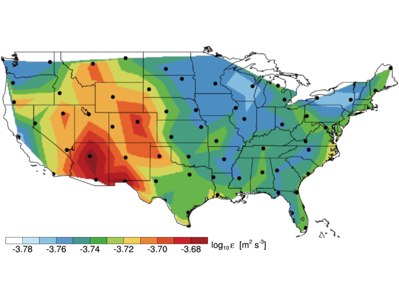
Radiosondes Measure Atmospheric Turbulence Over North America
Analyses of high-resolution radiosonde balloon measurements have provided a novel climatology of atmospheric turbulence parameters in the troposphere and lower stratosphere.
Posted inEditors' Highlights
Linking Regional Weather and Climate to Remote Events
A new index for quantifying regional sensitivities to the influence of periodic events.
Posted inNews
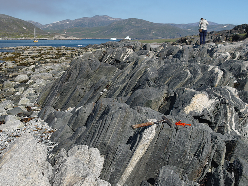
When Water Met Rock
Geologists discover rocks bearing the earliest known evidence of water interacting with rock on Earth’s surface.
Posted inNews
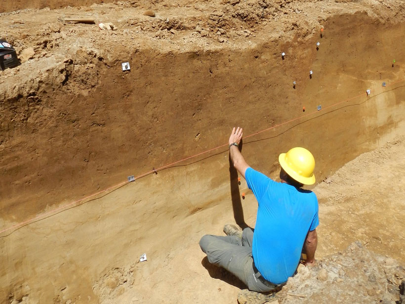
Secrets from the New Madrid Seismic Zone’s Quaking Past
High-resolution lidar topography reveals a long history of ancient earthquakes.