
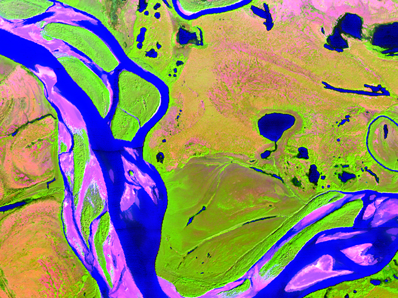
New satellite instruments and data, plus a more comprehensive observing network, are key to increasing our understanding of past and future change in the Arctic Boreal Zone.
remote sensing

Posted inNews
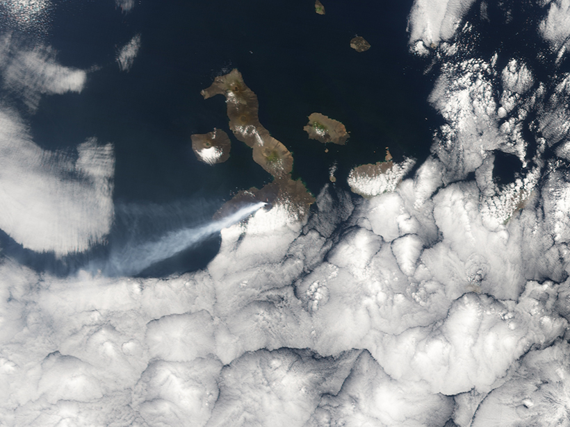
Taal Eruption and Ashfall Continue; Thousands Still at Risk
The Philippines’ volcanology institute warns that a hazardous eruption of Taal is imminent. In the past, Taal’s eruptions have lasted months and even years.

Posted inNews
Using Satellites and Supercomputers to Track Arctic Volcanoes
New data sets from the ArcticDEM project help scientists track elevation changes from natural hazards like volcanoes and landslides before, during, and long after the events.
Posted inResearch Spotlights
Forecasting Volcanic Eruptions with Artificial Intelligence
A machine learning algorithm automatically detects telltale signs of volcanic unrest.
Posted inNews
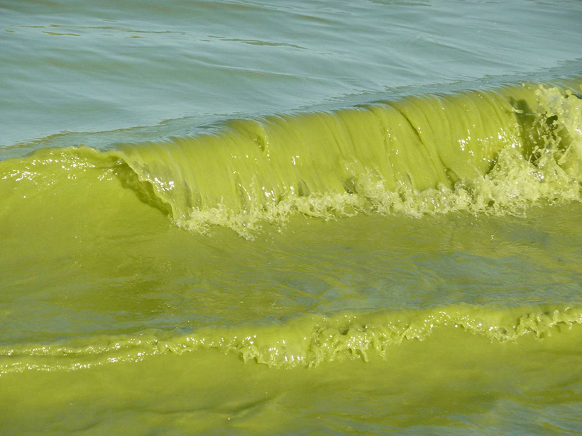
Toxic Algal Blooms Are Worsening with Climate Change
Researchers use remote sensing technology to carry out a global survey of large freshwater lakes.

Posted inNews
We Have Broken Nature into More Than 990,000 Little Pieces
Habitat fragmentation is splintering undeveloped areas on Earth.

Posted inNews
The Hazard Cascade That Led to the Anak Krakatau Landslide
Researchers used a combination of ground and space-based measures to look for warning signs for the flank collapse at Anak Krakatau in 2018, which triggered a tsunami that killed hundreds.
Posted inScience Updates
Watching Earth’s Interconnected Systems at Work
Surface Biology and Geology, a new NASA Earth observation effort, is developing a path forward for monitoring the Earth system from space.

Posted inEditors' Highlights
Machine Learning Improves Satellite Rainfall Estimates
A new deep learning approach bridges ground rain gauge and radar data with spaceborne radar observations of Tropical Rainfall Measuring Mission to improve precipitation estimation.

Posted inEditors' Highlights
Future Remote Sensing Mission Holds Promise for Flood Monitoring
The 2021 Surface Water and Ocean Topography (SWOT) mission will measure water surface elevation, slopes, and inundations of rivers as narrow as 50 meters.