
High nutrient levels in 2018 resulted in a nearly 9,000-kilometer belt of Sargassum, a seaweed critical to many marine animals but also a nuisance when it washes up on shorelines, new results reveal.
remote sensing
Posted inNews
What’s the True Shape of An Ocean Eddy?
Ocean eddies spin round and round, but not in a perfect circle.
Posted inEditors' Vox
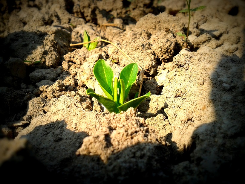
The Paramount Societal Impact of Soil Moisture
Recent technological innovations offer new opportunities for soil moisture characterization and monitoring from the pedon to global scales.
Posted inEditors' Highlights
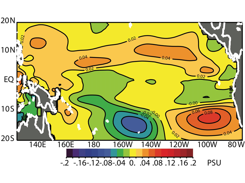
Salinity from Space Improves El Niño Forecasts
Assimilating satellite observations of ocean surface salinity significantly improves coupled model forecasts of El Niño.
Posted inScience Updates
Teams Invited to Test Coastal Hyperspectral Imaging Algorithms
Hyperspectral Remote Sensing of Coastal and Inland Waters Webinar; 28 May 2019

Posted inScience Updates
Monitoring Volcanic Craters with Infrasound “Music”
Volcanic craters act as giant horns that emit intense low-frequency sounds. Changes in this infrasound may be used to track rising lava lakes and identify signals of future eruptions.
Posted inEditors' Highlights
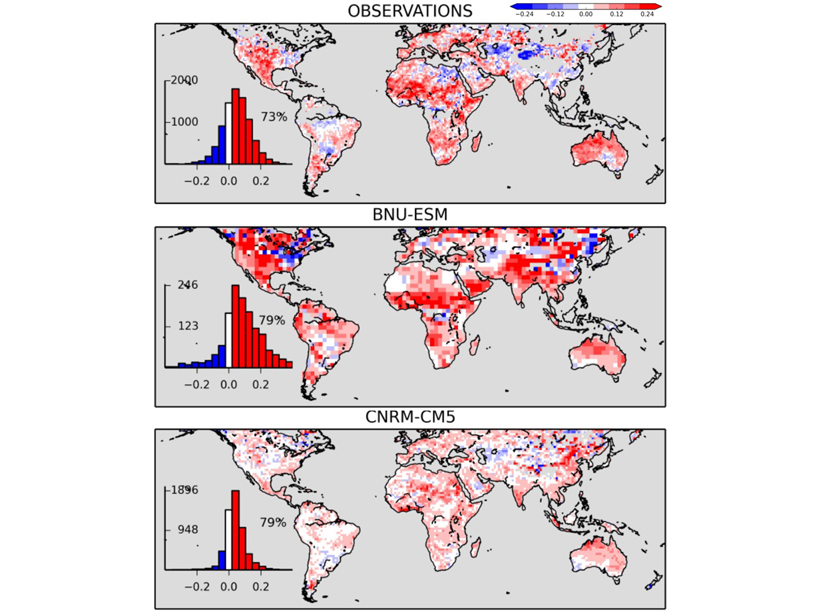
Diagnosing Soil Moisture Impacts on Model Energy Fluxes
Do climate models truthfully mimic how drying soil affects land-surface budget partition?

Posted inResearch Spotlights
Variations in Creep Along One of Earth’s Most Active Faults
Satellite-based radar images of motion along Turkey’s North Anatolian Fault are helping scientists understand when, where, and how creep occurs and its implications for seismic hazard.

Posted inResearch Spotlights
Missing Lakes Under Antarctic Ice Sheets
New radio sounding study finds little evidence of lakes under Antarctica’s Recovery Glacier.
Posted inNews
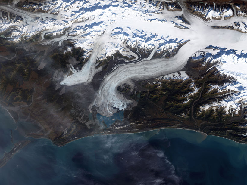
Seismic Clues to Surging Glaciers
Measuring seismic waves passing through a glacier suggests that not only is liquid water playing a role in periodic surging but the water is channeled into cracks from across the ice.