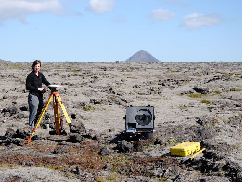
A novel method of calculating strain rates from GPS data shows the South Iceland Seismic Zone is experiencing rapid deformation, including inflation near the island’s most active volcano.
remote sensing

Posted inResearch Spotlights
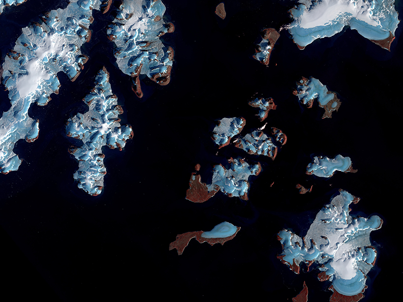
Mapping Ice Algal Blooms from Space
Satellite data reveal how colorful algae are melting the Greenland ice sheet.
Posted inNews
Fast-Melting Mountain Glaciers Speed Up Sea Level Rise
Satellites spy on remote alpine glaciers, producing more accurate—and higher—estimates of ice loss over time.

Posted inEditors' Vox
Measuring Explosive Events on Earth from the Ionosphere
Natural and manmade explosive events occurring on or below the Earth’s surface can be measured remotely in different ways and different places from the ionosphere.
Posted inNews
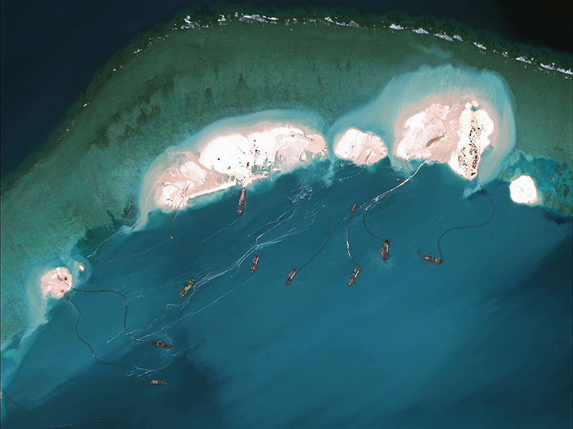
Island Building Alters Waters Leagues Away and for Years After
Quantifying the impacts of dredging through satellite remote sensing could serve as a valuable resource in future geopolitical disputes over contested waters.
Posted inResearch Spotlights
Are Soil Moisture and Latent Heat Overcoupled in Land Models?
A novel statistical approach demonstrates how to reduce bias in remote sensing estimates of soil moisture and latent heat flux coupling strength and clarifies the relationship between the variables.
Posted inResearch Spotlights
Improving Water Resources Management with Satellite Data
An extensive review reveals that remote sensing is changing the way we manage water resources and suggests that the coming years will bring both exciting advancements and new challenges.

Posted inResearch Spotlights
The Thermosphere Responds to a Weaker Than Normal Solar Cycle
Infrared emissions from nitric oxide and carbon dioxide in Earth’s upper atmosphere, which are closely tied to incoming solar radiation, are drastically lower than in the previous solar cycle.

Posted inEditors' Highlights
Improving Retrievals for Vertically Inhomogeneous Warm Clouds
Cloud droplet size changes with height, but passive sensors are virtually blind to see it; however, combining passive with active sensors helps profile it in vertically inhomogeneous warm clouds.

Posted inEditors' Highlights
A Step Closer to Quantifying Global Photosynthesis in Real Time
High spatial and temporal resolutions of a data set on a proxy for plant photosynthesis, as well as contiguous global coverage, have great utility for a variety of applications.