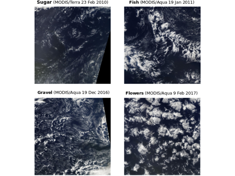
Satellite images of marine shallow clouds are objectively classified into four distinct types, illuminating new ways to tackle a long-standing problem in climate predictions.
remote sensing

Posted inNews
Urban Heat Islands Are Warming the Arctic
Even in the remote high latitudes, a new satellite study sees rising temperatures and spreading green belts around cities, with big impacts on soils and ecosystems.
Posted inAGU News
Kustas Receives 2019 Hydrologic Sciences Award
William P. Kustas received the 2019 Hydrologic Sciences Award at AGU’s Fall Meeting 2019, held 9–13 December in San Francisco, Calif. The award is for “outstanding contributions to the science of hydrology.”
Posted inScience Updates
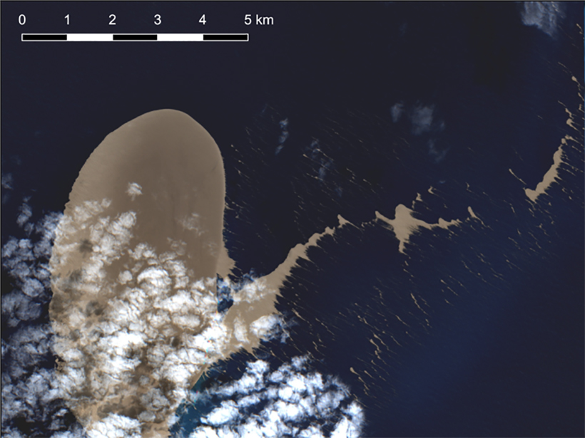
Satellite Sleuthing Detects Underwater Eruptions
Satellite data helped scientists locate the volcanic source of a pumice raft floating in the South Pacific Ocean, illustrating their promise in locating and monitoring undersea eruptions.

Posted inResearch Spotlights
Snowpack Data Sets Put to the Test
A new study compares the accuracy of three observation-based methods of calculating snow water equivalent, a key component in water management.
Posted inEditors' Highlights
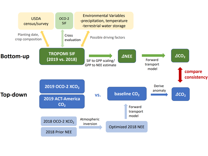
Toward Forecasting Crop Productivity and Carbon Flux Anomalies
Quantifying reductions in U.S. Midwest crop productivity and carbon uptake due to 2019 flooding using combined satellite observations of solar-induced chlorophyll fluorescence and atmospheric CO2.

Posted inNews
Leveraging Satellite Sensors for Oil Spill Detection
By using multiple remote sensors, scientists can quickly estimate the nature and thickness of oil spills—important factors for containment efforts.
Posted inResearch Spotlights
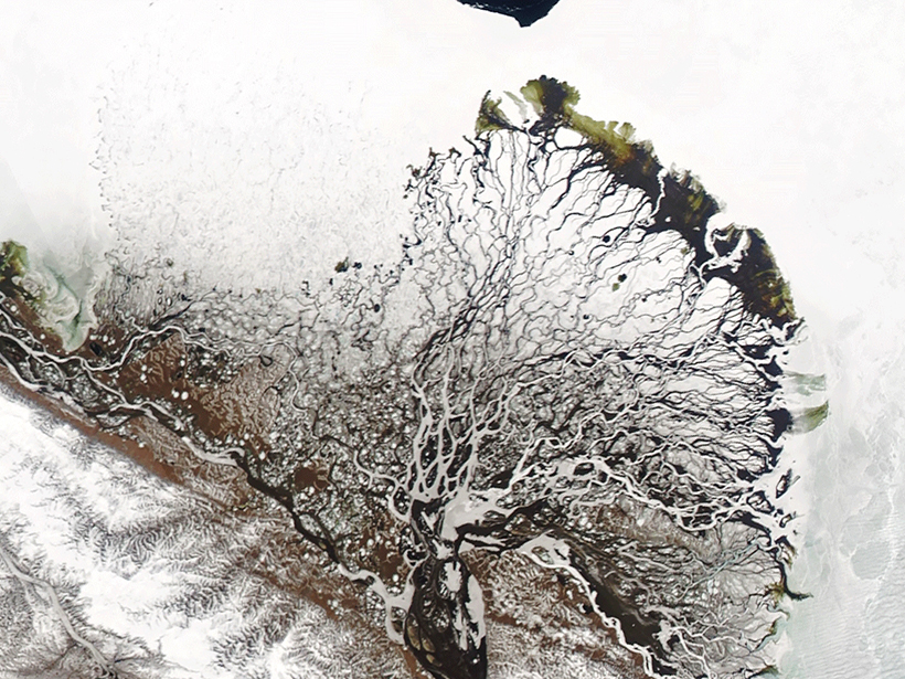
River Deltas at the Top of the World
The water that filters through river deltas has a large effect on the Arctic Ocean. A new study explores factors that shape Arctic river deltas and how delta form in turn changes water flow.
Posted inScience Updates
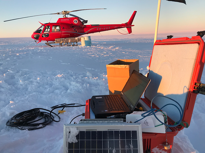
A Shared Resource for Studying Extreme Polar Environments
A new community pool of seismic instrumentation will facilitate and advance geologic and cryospheric research in Earth’s ice-covered environments.
Posted inNews
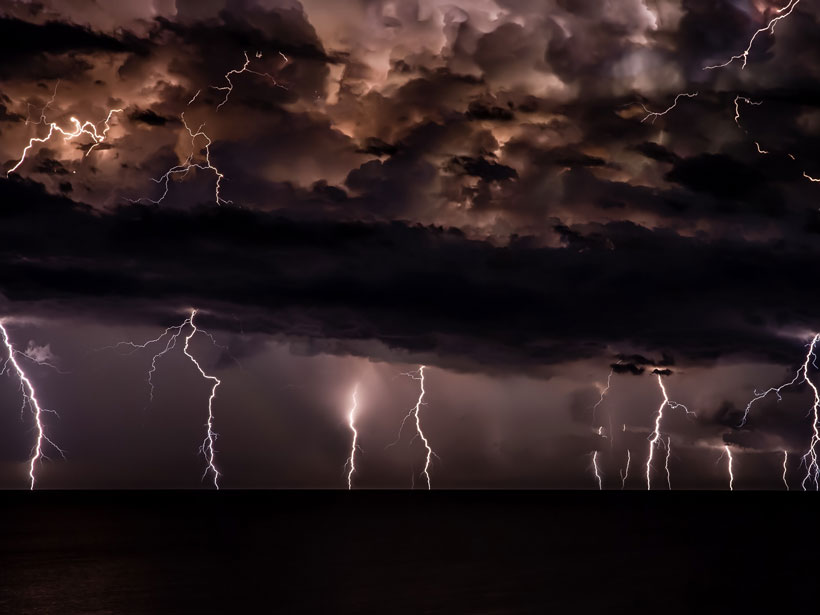
Mapping Lightning Strikes from Space
A new technique spatially tracks lightning in real time and has been adapted by the National Weather Service.