
A new initiative combines satellite data with ground observations to assess and predict the risk of cholera outbreaks in Bangladesh’s vulnerable populations.
remote sensing
Posted inEditors' Highlights
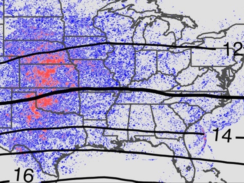
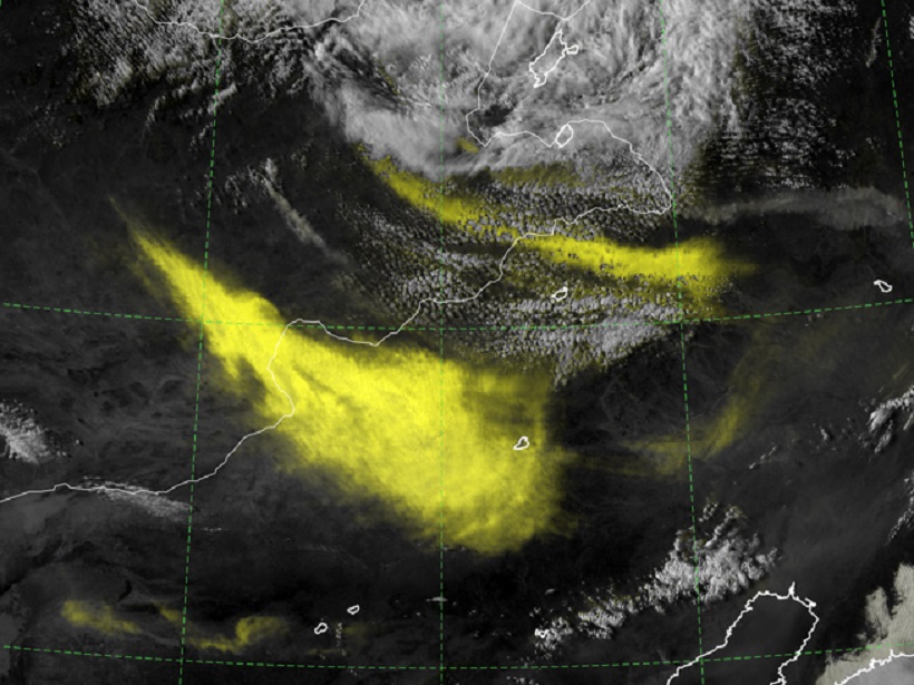
Continental Convection Reaches New Highs
Ten years of high-resolution gridded NEXRAD radar data provide a new data set to quantify tropopause-overshooting convection over the continental United States.

Posted inScience Updates
Toward a Satellite-Based Monitoring System for Water Quality
Water Quality Workshop for End Users; Greenbelt, Maryland, 27 September 2017
Posted inResearch Spotlights
Measuring Hurricane Wind Speed from Space
A new technique based on GPS signals could provide better wind speed measurements during hurricanes and cyclones.

Posted inScience Updates
Monitoring Tropical Cyclones with Lightning and Satellite Data
A new storm-following tool continually watches for lightning over the open ocean. Combined with satellite microwave data, the new real-time observations will improve forecasts of tropical cyclones.
Posted inNews
Report Recommends Priorities for Earth Observations from Space
The new strategic plan, which builds on earlier road maps for observing the planet, identifies top targets for satellite scrutiny for the next decade.

Posted inScience Updates
The Amazon River’s Ecosystem: Where Land Meets the Sea
What happens to plant matter on its journey down the Amazon River to the Atlantic Ocean? One research group investigated the region where river and ocean meet to fill in this part of the story.
Posted inResearch Spotlights
Using Radar to Understand How Volcanic Eruptions Evolve
Radar satellite imagery can be used to measure constructional changes in the topography of long-lived volcanoes, according to a new study of Ecuador’s El Reventador volcano.

Posted inResearch Spotlights
Scientists Probe Water Inside Leaves via Satellite
Improving satellite-based studies of vegetation optical depth, a critical ecosystem indicator.
Posted inEditors' Highlights
Addition by Subtraction: Raising the Bar for Satellite Imagery
When it comes to forecaster analysis of complex satellite imagery, less can be more, and a new technique aims to simplify imagery interpretation by suppressing the background noise.