Eric F. Wood was awarded the 2017 Robert E. Horton Medal at the American Geophysical Union Fall Meeting Honors Ceremony, held on 13 December 2017 in New Orleans, La. The medal is for “outstanding contributions to hydrology.”
remote sensing

Posted inNews
Advanced Satellite Tracks Air Pollution in Extraordinary Detail
The unparalleled resolution of the European Space Agency’s Sentinel-5P’s spectrometer will allow scientists to pinpoint pollution sources, the agency reports.

Posted inNews
New Model Predicts Lightning Strikes; Alert System to Follow
Data from thousands of past storms help guide a new forecast model that predicts where and when lightning may hit.

Posted inResearch Spotlights
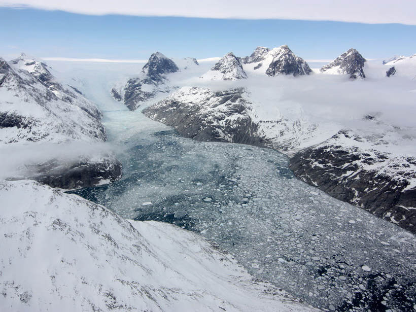
Reducing Errors in Satellite-Derived Arctic Sea Ice Thicknesses
Salty snow throws off satellite-based estimates of Arctic sea ice thickness by up to 25%. A new method seeks to fix that.
Posted inResearch Spotlights
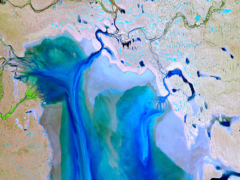
Satellites Accurately Capture Ocean Salinity in the Arctic
On-the-ground measurements are notoriously difficult in the harsh environment of the Arctic, but satellites could help close the gap in measuring sea surface salinity.

Posted inResearch Spotlights
Tracing Water’s Path Through the Santa Clara Valley Aquifer
In an increasingly drought prone climate, scientists study the impacts of drought on aquifer systems.

Posted inOpinions
Monitoring Coastal Zone Changes from Space
The resilience of coastal communities depends on an integrated, worldwide coastal monitoring effort. Satellite observations provide valuable data on global to local scales.
Posted inScience Updates
Observing Life near the Ocean’s Surface with Satellites
Third International Ocean Colour Science (IOCS) Meeting; Lisbon, Portugal, 15–19 May 2017

Posted inResearch Spotlights
Ocean Showers Power the Global Electric Circuit
Satellite measurements confirm hundred-year-old observations collected by boat.
Posted inAGU News
Nakajima Receives 2017 Yoram J. Kaufman Unselfish Cooperation in Research Award
Teruyuki Nakajima will receive the 2017 Yoram J. Kaufman Unselfish Cooperation in Research Award at the 2017 American Geophysical Union Fall Meeting, to be held 11–15 December in New Orleans, La. The award recognizes “broad influence in atmospheric science through exceptional creativity, inspiration of younger scientists, mentoring, international collaborations, and unselfish cooperation in research.”