
A novel antenna design promises to improve bandwidth and allow for better communication between Earth stations and satellites.
satellites

Posted inScience Updates
Scientists Invited to Collaborate in Satellite Mission’s Debut
The Surface Water and Ocean Topography mission will begin by scanning Earth’s surface once a day. We invite ocean scientists to contribute ground-based measurements to compare with the satellite data.

Posted inEditors' Highlights
First Multi-Decade Simulation of the Earth’s Radiation Belt
A new simulation of the Earth’s electron radiation belts captures large-scale variations over nearly three solar cycles, and replicates primary cyclical features and extreme behaviors.
Posted inNews
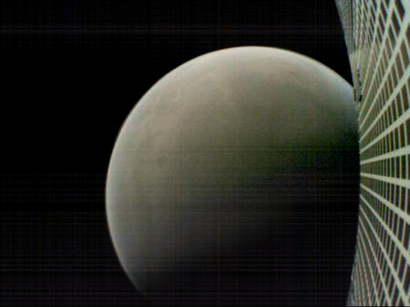
Hello, Goodbye: First Interplanetary CubeSats Zip Past Mars
The InSight lander safely arrived on Mars early last week. Two tiny spacecraft made up part of its communications array and transmitted landing data back to Earth.
Posted inEditors' Highlights
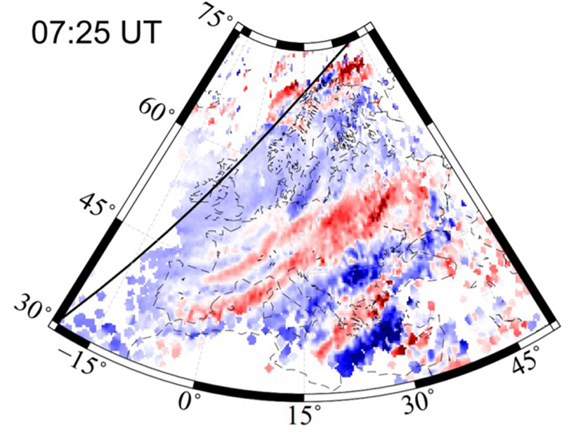
Seeing Waves: GNSS Tracking of Waves in the Upper Atmosphere
Dense GNSS networks enable scientists to track large-scale waves traveling through the upper atmosphere, away from sources in the auroral zone and the day/night terminator.

Posted inOpinions
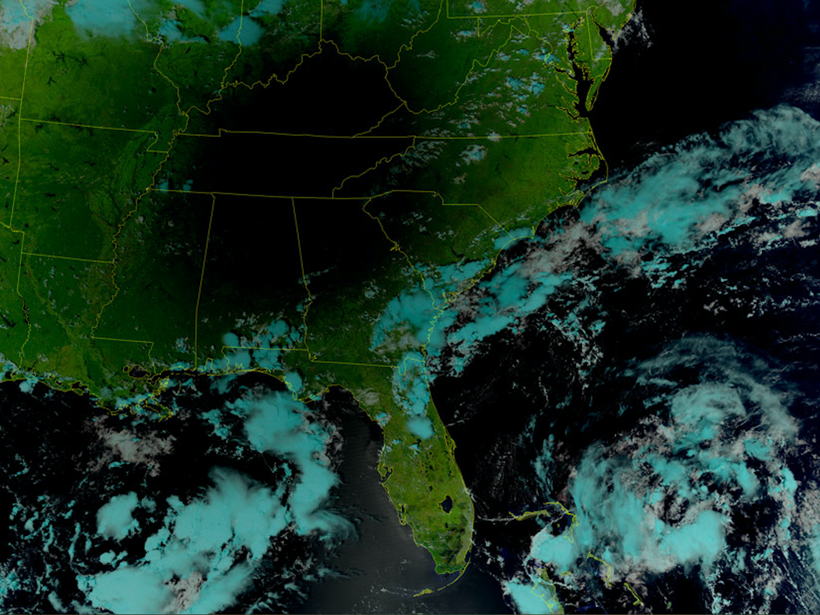
Wireless Frequency Sharing May Impede Weather Satellite Signals
The delivery of weather satellite imagery is reliable today, but will it stay that way in the future?
Posted inEditors' Highlights
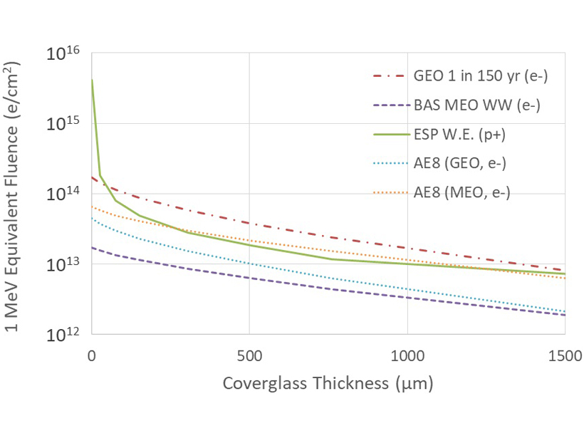
Double Threat to Solar Panels in Space
Protons accelerated in solar storms and electrons accelerated in geospace storms can reduce space mission lifetimes. What is the likelihood of extreme events during geospace storms?
Posted inNews
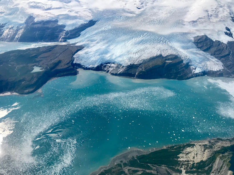
Global Ice Monitoring Satellite to Launch as Early as This Week
The soon-to-launch satellite will measure the height and thickness of sea ice, glaciers, ice sheets, and permafrost around the world to an unprecedentedly high precision.
Posted inScience Updates
Scientists Meet to Review Preparations for Satellite Launch
Center for Satellite Applications and Research JPSS 2017 Annual Science Team Meeting; College Park, Maryland, 14–18 August 2017
Posted inNews
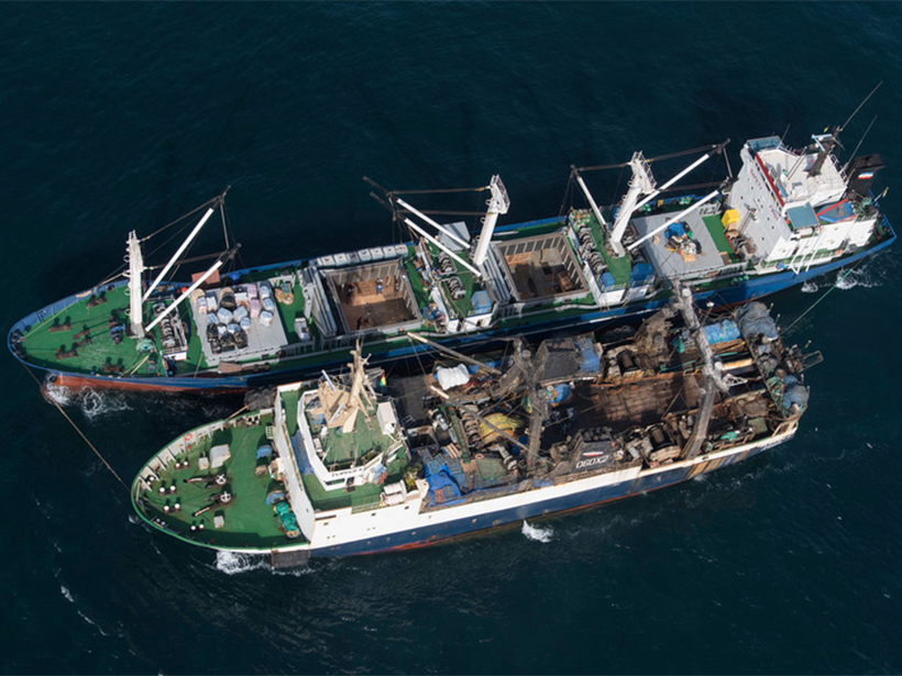
Illegal Seafood Supply Chains Can Now Be Tracked by Satellite
Researchers pinpoint more than 10,000 likely transfers of catches between fishing vessels and cargo ships at sea. Knowing where these transfers occur can help officials crack down on illegal activity.