Photo of a crop field with mountains in the background.
Nadunget Sub-County, Moroto District, Uganda in August 2016. Credit: Catherine Nakalembe
Editors’ Highlights are summaries of recent papers by AGU’s journal editors.
Source: AGU Advances

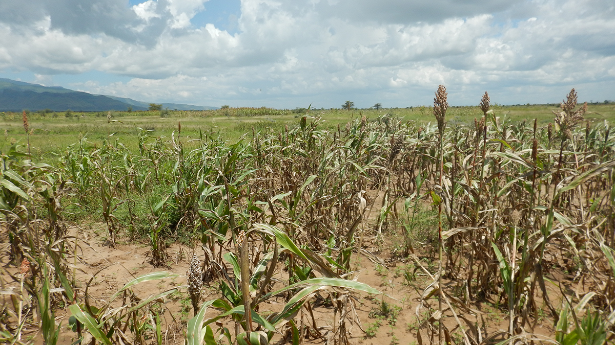
Technologies for Earth observation by satellites have been used to give advance warning of potentially imminent crop failure due to drought conditions. These risks are increasing with climate change and are especially concerning for middle- and low-income countries that are vulnerable to food insecurity.

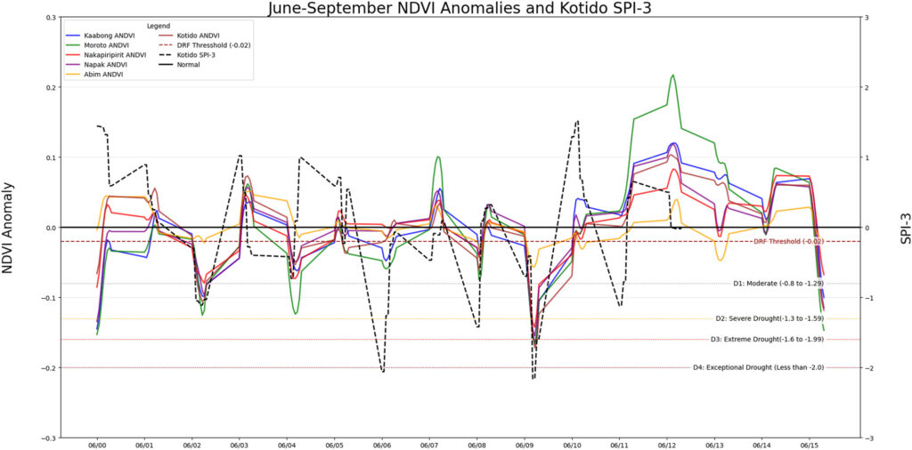
Nakalembe [2026] reports on the effectiveness of Uganda’s Disaster Risk Financing Program, which pioneered satellite-triggered financing for drought disaster relief operating at scale. The $14 million program yielded $40.7 million in total benefits, including $11.1 million in immediate emergency aid cost savings. In addition to offering lessons learned, this commentary concludes that institutional and financial barriers, rather than technical limitations, now constrain the scaling of this satellite-driven climate resilience mechanism. Similar programs may reduce vulnerabilities worldwide, as climate disasters become increasingly frequent and severe.

Anomalies in the Normalized Difference Vegetation Index (ANDVI) from satellites and the Standardized Precipitation Index (SPI-3) during the peak growing season (June – September) of each year from 2000 to 2015 across the Karamoja Region of Uganda. The solid-colored lines show ANDVI (left axis) for six Ugandan districts, with negative values indicating reduced crop health. A horizontal dashed line at -0.02 ANDVI represents the trigger threshold for activating financial assistance by Ugandan government agencies. The dashed black line illustrates precipitation anomalies from SPI-3 (right axis), with classification of drought severity indicated by horizontal lines D1-D4 at negative SPI-3 values. Note that the in years when the SPI-3 index dropped below the drought severity lines (D1-D4), many of the ANDVI values for the six districts (colored lines) also become negative, often below the threshold of -0.02, indicating a crop response to drought that warns of potential crop failure and proactively triggers governmental disaster relief. Credit: Nakalembe [2026], Figure 1

Citation: Nakalembe, C. (2026). Lessons From Uganda’s Earth Observation-Based Disaster Risk Financing Program. AGU Advances, 7, e2025AV002224. https://doi.org/10.1029/2025AV002224

—Eric Davidson, Editor, AGU Advances

he logo for the United Nations Sustainable Development Goal 2 is at left. To its right is the following text: The research reported here supports Sustainable Development Goal 2. AGU is committed to supporting the United Nations 2030 Agenda for Sustainable Development, which provides a shared blueprint for peace and prosperity for people and the planet, now and into the future.
Text © 2026. The authors. CC BY-NC-ND 3.0
Except where otherwise noted, images are subject to copyright. Any reuse without express permission from the copyright owner is prohibited.