
Archaeologists digging in Martinique chanced upon the first tsunami deposit from the earthquake found in the New World. The tsunami left a strong trace, it seems, because the wave went up a river.
Hazards & Disasters

Posted inNews
Deepwater Horizon Dispersant Cleared the Air, New Model Shows
A simulation of oil and gas leakage during the Deepwater Horizon disaster finds that the main chemical dispersant used improved air quality for emergency responders.

Posted inResearch Spotlights
Revising an Innovative Way to Study Cascadia Megaquakes
Researchers probe natural environments near subduction zones to decrypt underlying mechanisms of major earthquakes.

Posted inNews
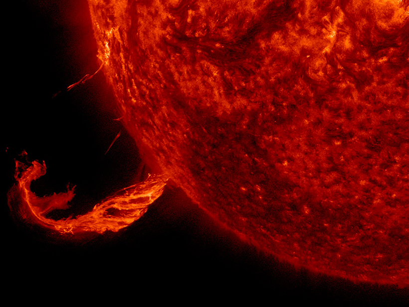
Largest Flare of Past 9 Years Erupts from Sun
A massive flare and blast of charged particles toward Earth may disrupt satellites and communications and push auroras toward lower latitudes through tomorrow, according to space weather experts.

Posted inNews
Hurricane Irma Tears Across Caribbean, Heads to South Florida
Florida residents prepare for potentially catastrophic winds and flooding.

Posted inOpinions
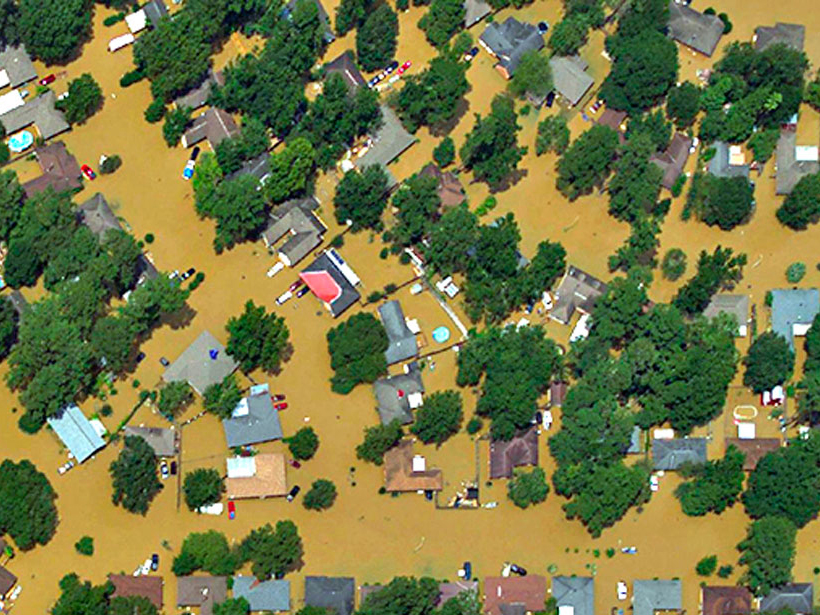
A Diary of a Storm
When Hurricane Harvey struck Texas more than a week ago, an Eos staff editor based in Houston hunkered down. Here’s her day-by-day account of the storm and its aftermath.
Posted inResearch Spotlights
Federal Space Weather Research Could Improve Hazard Preparation
Researchers outline the history of the U.S. government’s involvement in space weather research, from before World War II, through the Space Race, and beyond.

Posted inNews
Big Space Rock to Pass near Earth on Friday
An asteroid named for Florence Nightingale will make its closest approach to our planet since 1890 but will remain a safe distance away.
Posted inResearch Spotlights
Deciphering Deluges
New modeling approach reexamines two key assumptions about flooding.

Posted inFeatures
The Legacy of the 1992 Nicaragua Tsunami
A powerful tsunami struck Nicaragua’s Pacific coast 25 years ago. In its wake emerged the first coordinated collaboration among international tsunami scientists.