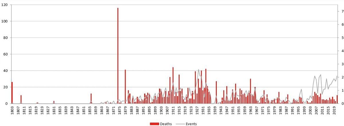
The Landslide Blog is written by Dave Petley, who is widely recognized as a world leader in the study and management of landslides. A fascinating new paper (Corominas et al. 2025) has just been published in the journal Geoenvironmental Disasters that describes the compilation and analysis of a new dataset on fatal non-seismic rockfalls in […]
Hazards & Disasters
Posted inThe Landslide Blog
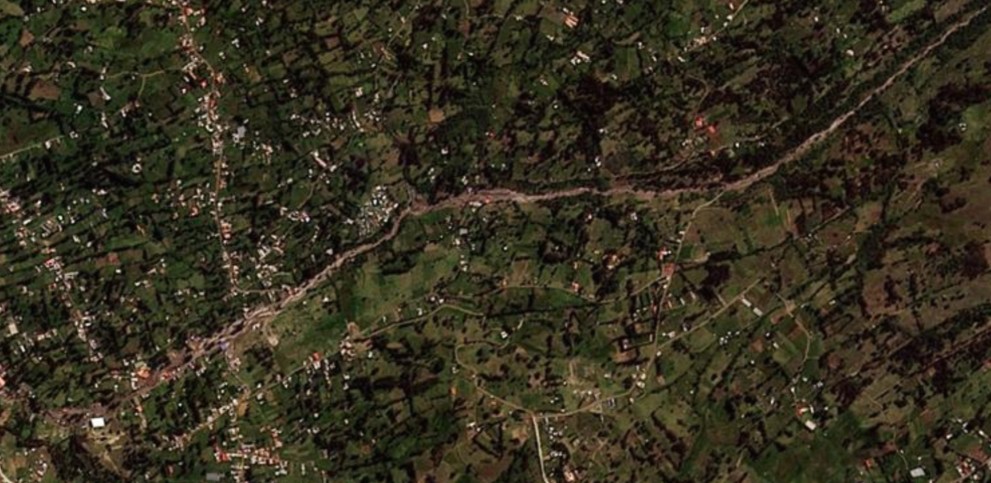
The 28 April 2025 Glacial Outburst Flood (GLOF) / landslide at Vallunaraju in Peru
The Landslide Blog is written by Dave Petley, who is widely recognized as a world leader in the study and management of landslides. On 28 April 2025, a major debris flow travelled down a channel from a major mountain, Vallunaraju, striking the communities lower down the slope. At least 100 houses were destroyed and two […]
Posted inNews
Climate Change Heightened Conditions of South Korean Fires
Unusually low rainfall and humidity, combined with windier days, made the catastrophic wildfires more likely.
Posted inResearch Spotlights
Matching Magma Dikes May Have Different Flow Patterns
A set of lab experiments involving a laser, gelatin, and xanthan gum explored how varying flow patterns between dikes with similar speeds and shapes could affect eruption predictions.
Posted inThe Landslide Blog
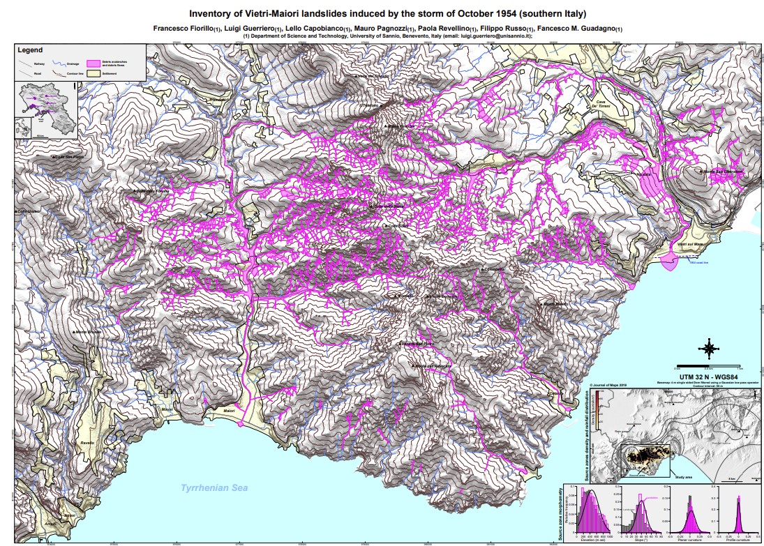
The 25 October 1954 landslide disaster on the Amalfi Coast of Italy
The Landslide Blog is written by Dave Petley, who is widely recognized as a world leader in the study and management of landslides. I have frequently highlighted the growing impact of multiple landslide events triggered by extreme rainfall around the world. Whilst there is little doubt that such events are becoming more common, they have […]
Posted inEditors' Highlights
The All-In-One Cyclone Identification Framework
Researchers present a new framework for global detection and classification of all low-pressure systems.
Posted inResearch Spotlights
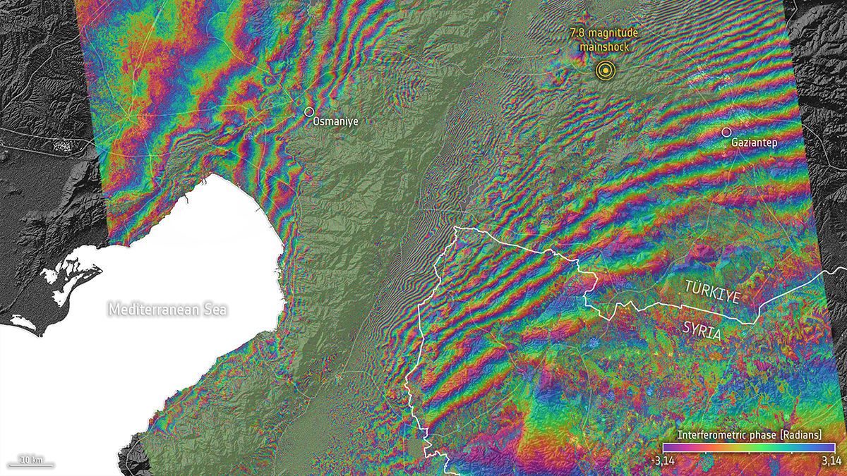
Türkiye-Syria Temblors Reveal Missing Piece in Earthquake Physics
Newly discovered aseismic events triggered by the 2023 Kahramanmaraş earthquake may represent a mode of fault slip between earthquakes and slow-slip events that researchers have long been seeking.
Posted inThe Landslide Blog
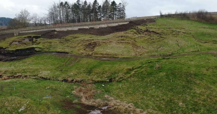
Remediating the Browney Curve landslide in County Durham
The Landslide Blog is written by Dave Petley, who is widely recognized as a world leader in the study and management of landslides. Rail Advent has a very nice article that describes the now completed repair of the Browney Curve landslide on the East Coast Mainline railway line in England. This is a site that […]
Posted inThe Landslide Blog
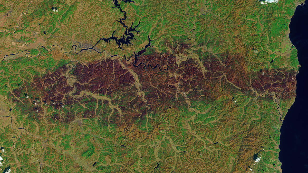
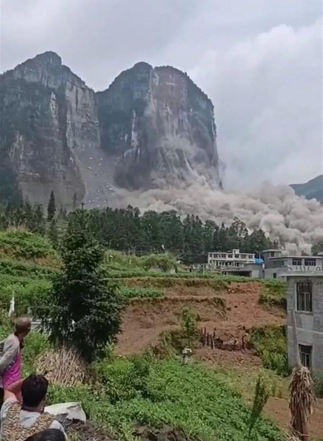
The 8 May 2022 Baiyan rock avalanche in Guizhou, China
The Landslide Blog is written by Dave Petley, who is widely recognized as a world leader in the study and management of landslides. On 8 May 2022, the catastrophic Baiyan rock avalanche occurred in Zhijin County, which is located in Guizhou Province, China. The digital lat/long is [26.63771, 105.69200]. I described this event at the time […]
Posted inThe Landslide Blog
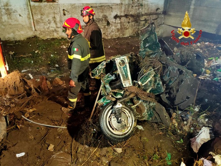
The 27 August 2024 post-fire debris flows in San Felice a Cancello, Italy
Guest post by Giuseppe Esposito and Stefano Gariano The Landslide Blog is written by Dave Petley, who is widely recognized as a world leader in the study and management of landslides. In a recent article published in the journal Landslides, Esposito and Gariano (2025) describe the first post-fire debris flow event with fatal consequences recorded […]