• About
  • Special Reports
  • Topics
    • Climate
    • Earth Science
    • Oceans
    • Space & Planets
    • Health & Ecosystems
    • Culture & Policy
    • Education & Careers
    • Opinions
  • Projects
    • Postcards From the Field
    • ENGAGE
    • Editors’ Highlights
    • Editors’ Vox
    • Eos en Español
    • Eos 简体中文版
    • Print Archive: 2015–2025
  • Policy Tracker
  • Blogs
    • Research & Developments
    • The Landslide Blog
  • Newsletter
  • Submit to Eos
  • AGU.org
  • Career Center
  • Join AGU
  • Give to AGU
  • About
  • Special Reports
  • Topics
    • Climate
    • Earth Science
    • Oceans
    • Space & Planets
    • Health & Ecosystems
    • Culture & Policy
    • Education & Careers
    • Opinions
  • Projects
    • Postcards From the Field
    • ENGAGE
    • Editors’ Highlights
    • Editors’ Vox
    • Eos en Español
    • Eos 简体中文版
    • Print Archive: 2015–2025
  • Policy Tracker
  • Blogs
    • Research & Developments
    • The Landslide Blog
  • Newsletter
  • Submit to Eos
Skip to content
  • AGU.org
  • Career Center
  • Join AGU
  • Give to AGU
Eos

Eos

Science News by AGU

Support Eos
Sign Up for Newsletter
  • About
  • Special Reports
  • Topics
    • Climate
    • Earth Science
    • Oceans
    • Space & Planets
    • Health & Ecosystems
    • Culture & Policy
    • Education & Careers
    • Opinions
  • Projects
    • Postcards From the Field
    • ENGAGE
    • Editors’ Highlights
    • Editors’ Vox
    • Eos en Español
    • Eos 简体中文版
    • Print Archive: 2015–2025
  • Policy Tracker
  • Blogs
    • Research & Developments
    • The Landslide Blog
  • Newsletter
  • Submit to Eos

Hazards & Disasters

A map of land surface temperatures across the Pacific Northwest. Temperature is shown as a color gradient from blue to red.
Posted inResearch Spotlights

Far-Flung Forces Caused the 2021 Pacific Northwest Heat Wave

by Saima May Sidik 23 December 20221 March 2023

Air from thousands of kilometers away spiraled down to drape the Pacific Northwest in blistering heat.

Refugia dot a hillside in the western Cascades after the 2020 Holiday Farm Fire, one of the largest blazes in Oregon’s history.
Posted inFeatures

Last Tree Standing

by Robin Donovan 22 December 202222 December 2022

Refugia repopulate forests after fires, but climate change is making these woodlands increasingly unpredictable.

Close-up of the palm leaves of Babad Lombok held together by a string threaded through a hole in each page. Each side of the palm leaves shows inscriptions in Old Javanese.
Posted inNews

Stories Scribed on Palm Leaves Help Scientists Understand Ancient Eruption

by Alka Tripathy-Lang 19 December 202219 December 2022

Deposits from the 1257 Samalas eruption may contain artifacts of an ancient kingdom, according to scientists who link volcanology studies with histories written onto palm leaves.

Satellite image of Earth showing the atmospheric plume blanketing the Pacific after the underwater eruption of Hunga Tonga–Hunga Ha‘apai
Posted inNews

Social Media Posts Reveal Human Responses to Deadly Tongan Eruption

by Erin Martin-Jones 14 December 202214 December 2022

Quantifying human responses to natural disasters could improve preparation for future threats, scientists say.

Leola Rutherford, dressed in a pink shirt and maroon vest, sits at a roundtable with ANGLE workshop attendees. Two participants are operating earthquake machines.
Posted inNews

Geohazard Education Trainings Foster Resilience in Rural Alaska

by Anna Marie Yanny 13 December 202215 December 2022

National Science Foundation-funded teacher and community workshops boost disaster preparedness optimism among coastal Alaskan educators, whose communities face an array of natural hazards.

A map of the world centered on the Pacific Ocean, with continents in gray and oceans in white. Lines of bright colors cross the oceans and wind around continents, depicting the locations of transoceanic subsea cables.
Posted inNews

Making Underwater Cables SMART with Sensors

by Alka Tripathy-Lang 12 December 202212 December 2022

Future cables that stretch across the ocean, transmitting cat videos and financial transactions, could also contain temperature, pressure, and seismic sensors that would allow scientists to spy on the seafloor.

Two maps showing the location and main tectonic features of the 1987 Edgecumbe earthquake.
Posted inEditors' Highlights

Coseismic Displacement of 1987 Earthquake from Aerial Images

by Daniel Melnick 8 December 20226 December 2022

Differencing digital surface topography models constructed from historical aerial photographs reveal the coseismic surface displacement field of the 1987 earthquake in northern New Zealand.

A 2017 landslide in Freetown, Sierra Leone, killed an estimated 1,100 residents, largely in informal settlements.
Posted inNews

Protecting Poor Neighborhoods from Landslide Risk

by J. Besl 8 December 20221 June 2023

As low-income, informal settlements bloom in the tropics, their risk of landslides increases. A new modeling tool incorporates urbanization factors to protect the region’s poorest neighborhoods.

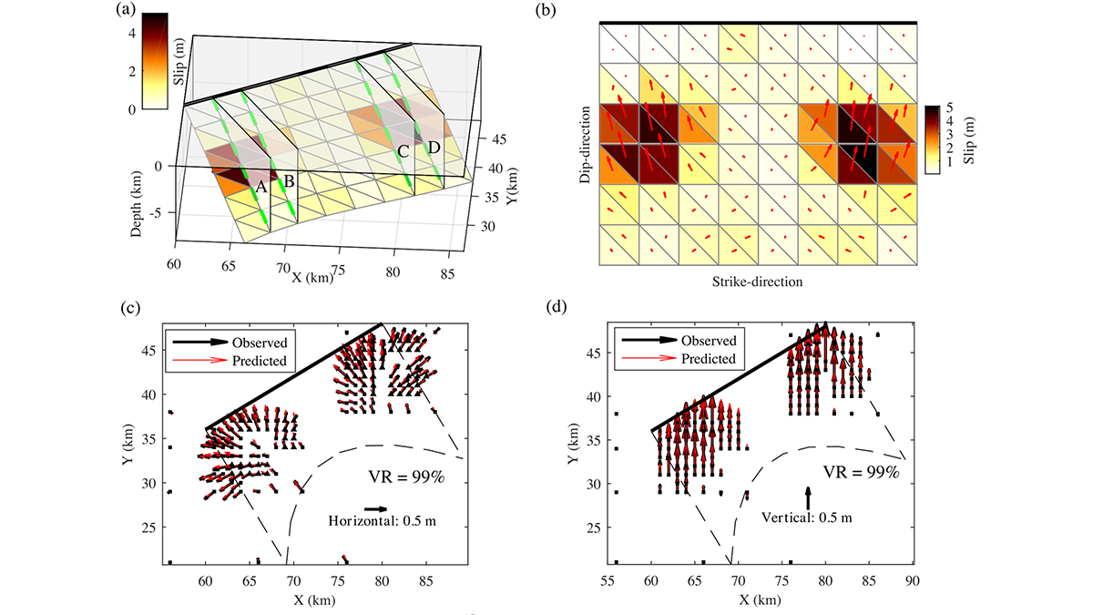
A GPS sensor sits atop the edge of a rocky cliff overlooking a steep slope down to water in the distance.
Posted inResearch Spotlights

Enhancing Earthquake Detection from Orbit

Sarah Stanley, Science Writer by Sarah Stanley 2 December 20222 December 2022

A new application of machine learning boosts scientists’ ability to use data from satellite navigation systems to detect and warn of earthquakes.

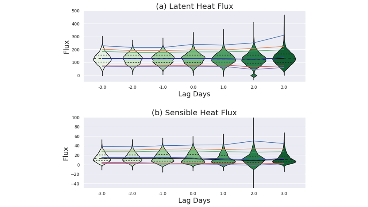
Four graphs from the paper showing temperature trends and probability of heat events.
Posted inEditors' Highlights

Characteristics of the 2021 Pacific Northwest Heatwave

by Suzana Camargo 30 November 20222 December 2022

Examining the 2021 Pacific Northwest heatwave using both historical observations and model simulations.

Posts pagination

Newer posts 1 … 59 60 61 62 63 … 181 Older posts
Over a dark blue-green square appear the words Special Report: The State of the Science 1 Year On.

Features from AGU Publications

Research Spotlights

Extreme Heat May Drive Asthma Risk in Baltimore, Especially at Night

12 August 202612 August 2026
Editors' Highlights

How Fluid Mixing due to Kelvin-Helmholtz Instabilities Really Works

13 August 202613 August 2026
Editors' Vox

Introducing Research Letters in Paleoceanography and Paleoclimatology

12 August 202610 August 2026
Eos logo at left; AGU logo at right

About Eos
ENGAGE
Awards
Contact

Advertise
Submit
Career Center
Sitemap

© 2026 American Geophysical Union. All rights reserved Powered by Newspack