
The loss cone of energetic particles in the Earth’s inner magnetosphere is substantially modified during disturbed times, with important implications for the radiation-belt and ring current modeling.
Modeling

Posted inResearch Spotlights
Plant-Nibbling Insects May Make It Cloudier and Cooler
Insects that eat plant leaves could change the local atmosphere, but current climate models do not account for this impact.

Posted inNews
The Complex Relationship Between Hurricanes, Air Pollution, and Climate
A new study focuses on the frequency and distribution of tropical cyclones over the past 40 years.
Posted inEditors' Highlights
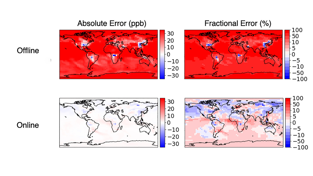
Accurate and Fast Emulation With Online Machine-Learning
Online training produces more accurate and stable machine-learned models than classic offline learning from big data sets.

Posted inResearch Spotlights
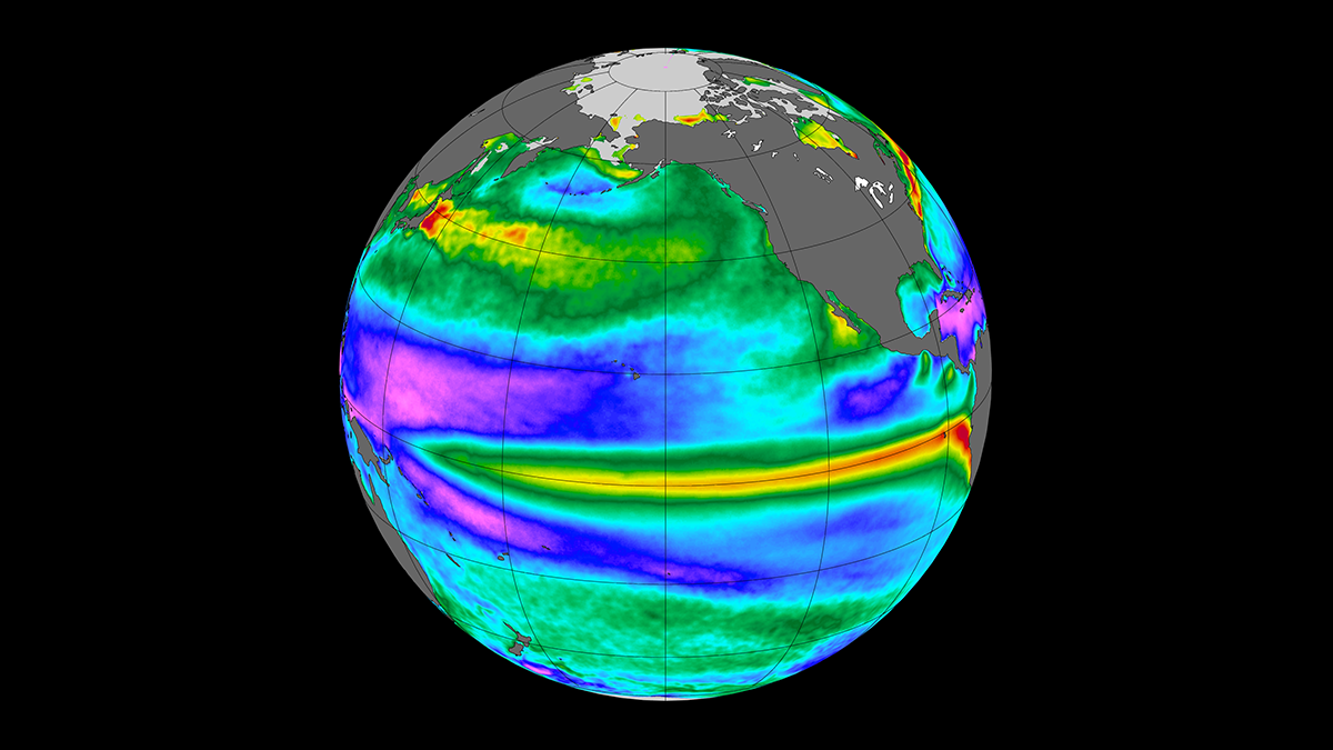
Spatial Scale Shapes the Ocean and Atmosphere’s Influence on the Climate
Researchers measured the processes driving heat exchange between the Pacific Ocean and the atmosphere.

Posted inResearch Spotlights
The Effects of Climate Change on U.S. Suicide Rates
Suicide incidence could increase by up to 1,660 cases annually, depending on how much the climate changes.
Posted inEditors' Highlights
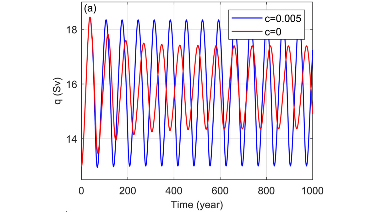
Arctic Salinity Pushes the AMOC Swing
A model of the Atlantic Meridional Overturning Circulation (AMOC), pioneered by Henry Stommel over 60 years ago, can exhibit realistic cyclic behavior if the role of Arctic salinity is included.

Posted inEditors' Highlights
Machine Learning Emulation of Atmospheric Radiative Transfer
Using machine learning to represent sub-grid processes in weather and climate models holds promise, but also faces challenges. Incorporating physical knowledge can help.
Posted inResearch Spotlights
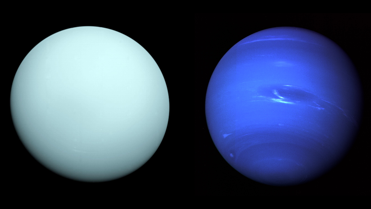
A Unified Atmospheric Model for Uranus and Neptune
In a new model, three substantial atmospheric layers appear consistent between the ice giants.