
A new book explores how Earth science knowledge addresses critical global challenges including sustainable development, disaster risk reduction, and climate change.
machine learning & AI

Posted inNews
New Landslide Reporting Tool Uses Social Media and AI
The tool extracts landslide information in real time, which could advance landslide research as well as disaster response.
Posted inResearch Spotlights
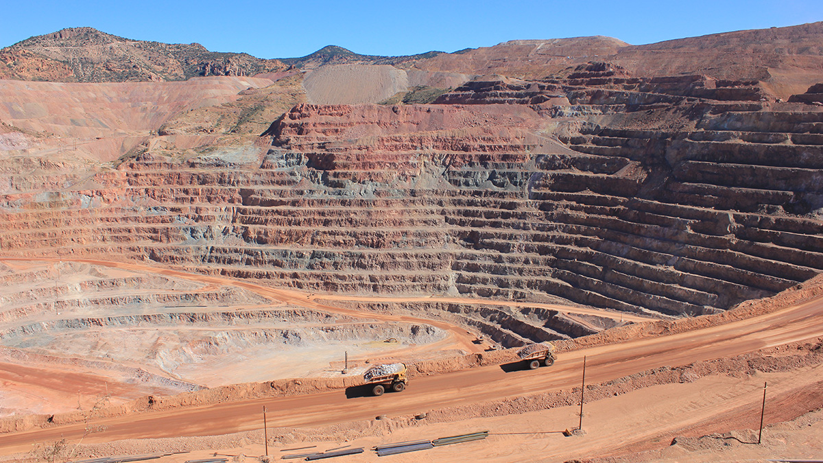
Machine Learning Could Revolutionize Mineral Exploration
Using a global data set of zircon trace elements, new research demonstrates the power of machine learning algorithms to accurately identify and locate porphyry copper deposits.

Posted inFeatures
11 Discoveries Awaiting Us at Solar Max
Each solar cycle might seem like the same old story, but one thing has changed significantly since the previous solar maximum–our technology.
Posted inEditors' Highlights
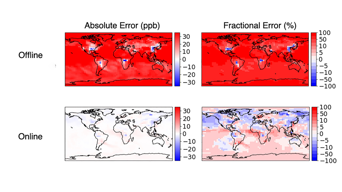
Accurate and Fast Emulation With Online Machine-Learning
Online training produces more accurate and stable machine-learned models than classic offline learning from big data sets.

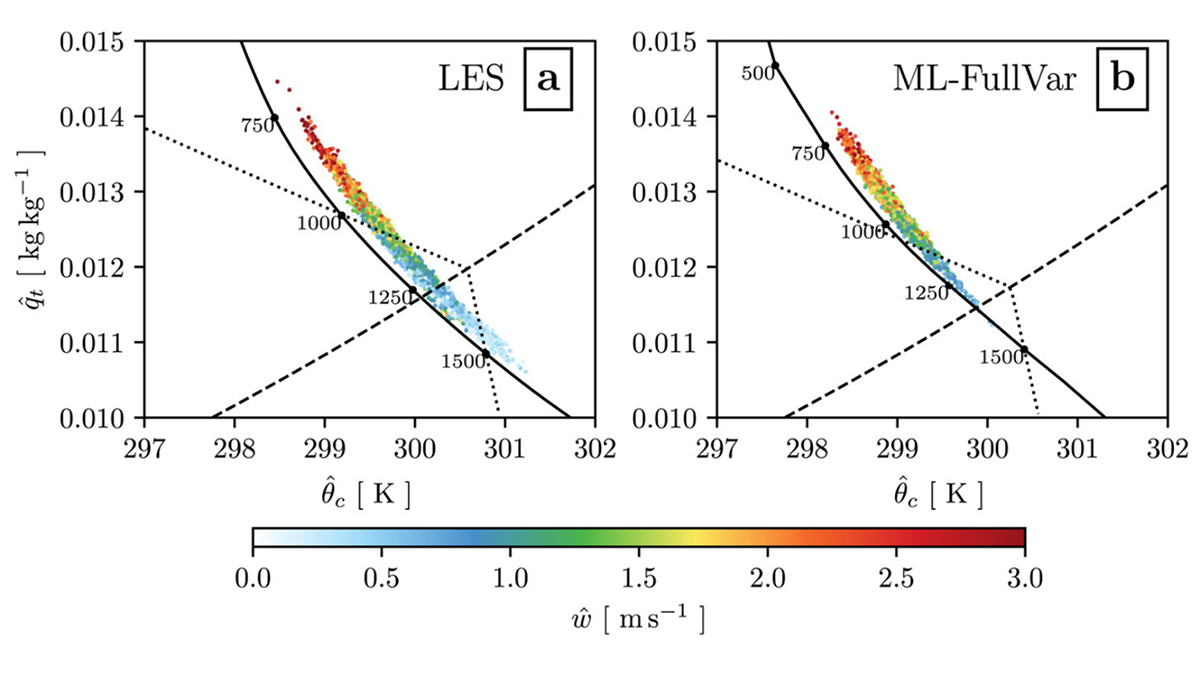
Posted inResearch Spotlights
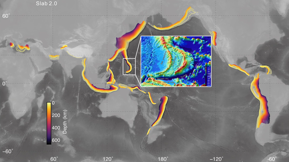
Deep Earthquakes Suggest Well-Hydrated Mariana Subduction Zone
Earthquakes as deep as 50 kilometers below the seafloor were detected by 12 ocean bottom seismometers placed around the Challenger Deep.

Posted inEditors' Highlights
Machine Learning Emulation of Atmospheric Radiative Transfer
Using machine learning to represent sub-grid processes in weather and climate models holds promise, but also faces challenges. Incorporating physical knowledge can help.
Posted inEditors' Highlights
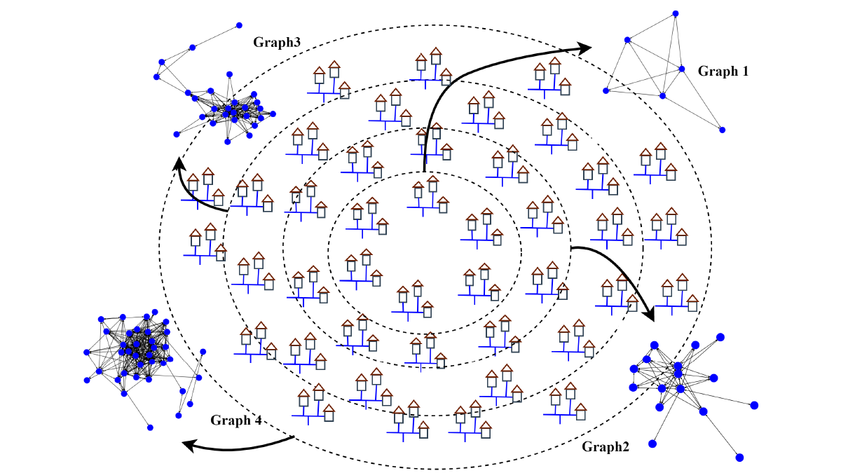
AI Algorithm Provides More Accurate Forecasts of Water Use
The new graph convolutional recurrent neural network (GCRNN) will enable water utilities to forecast water use, even if some sensors fail.
Posted inEditors' Highlights
Modeling Entrainment with Machine Learning
Researchers present a new approach to modeling the stochastic mixing process of convection using a machine learning technique.