A translation of this article was made possible by a partnership with Planeteando. Una traducción de este artículo fue posible gracias a una asociación con Planeteando.
The U.S. national security community, comprising agencies tasked with the country’s defense and intelligence gathering, needs reliable and current science to guide its decisionmaking with respect to climate change, the clean energy transition, water resources, and other complex issues.
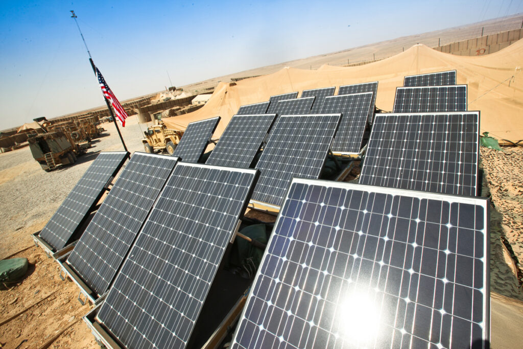
For example, climate change is affecting the stability of various nation-states. Decreasing Arctic sea ice volume and extent are driving changes in global navigation patterns. Locating new rare earth mineral deposits is critical for powering the next generation of civilian and military electric vehicles and aircraft. And military operations require access to potable water, necessitating understanding of changing freshwater resources.
However, the geoscience communities who study these issues do not routinely communicate with the national security community; instead, they more often use an over-the-transom approach to disseminate their research. That is, they publish their work in trade, scientific, and academic journals and hope it is recognized and used in policymaking. Unfortunately, this is an inefficient approach to knowledge sharing, and it often results in relevant research being overlooked by the national security community. On the other hand, the national security community collects data sets that can be useful to—but aren’t routinely shared with—geoscientists.
More direct and sustained engagement between these communities is needed to synthesize and simplify science and communicate it to nonscientists in the national security community. A first step toward fostering this engagement is increasing awareness of the long-standing and ongoing intersections between national security issues and geoscience among both communities. Beyond that, adopting a cross-community process to bring geoscientists and national security specialists together to share needs, knowledge, and data will help us address the complex problems facing the United States and the planet.
Science and Security
Historical connections between the national security and geoscience communities in the United States run deep, even as conceptions of national security have changed over time.
Historical connections between the national security and geoscience communities in the United States run deep, even as conceptions of national security have changed over time. The U.S. Weather Bureau (now the National Weather Service) began in the Army Signal Corps in 1870, surveilling striking workers and displaced Native Americans as well as storms before it became a civilian agency in 1891 [Fleming, 2000]. Since the 1940s, the bureau’s Special Projects Section (now NOAA’s Air Resources Laboratory) has continued to provide meteorological analysis relevant for modern applications such as nuclear security.
The U.S. Geological Survey (USGS) ran its Military Geology Program (now called Special Geologic Studies) during World War II, the Cold War, and other conflicts. The agency provided maps and reports covering topics such as rock type, soils, water resources, and landforms to help inform cross-country mobility and construction of infrastructure [Leith and Matzko, 1998].
In the academic community, the JASONS are an independent scientific advisory group created during the Cold War in 1960 to tackle sensitive defense questions. The group is overseen by the Federation of American Scientists and administered by the MITRE Corporation. Similarly, other federally funded research and development centers have provided and continue to provide support on national security topics in alignment with their government sponsors.
In 1992, the Central Intelligence Agency (CIA) stood up an Environmental Task Force (ETF) to review existing classified systems, data, and archives for their value in helping understand global climate change and other key environmental issues [Baker and Zall, 2020]. In 1993, the ETF, renamed MEDEA, became a partnership between the U.S. intelligence community and 70 U.S. academic and federal civilian scientists. This partnership focused on applying state-of the-art technologies to study how global environmental change was affecting ocean processes, ice and snow dynamics, atmospheric processes, land use and land cover dynamics, and geologic processes [Baker and Zall, 2020].
Thirty years later, these MEDEA-created studies, now titled the Global Fiducials Program (GFP), are overseen by the USGS and the interagency Civil Applications Committee (CAC). The CAC bridges the gap between federal civilian scientists, the U.S. Department of Defense (DOD), and intelligence community partners with respect to geospatial information and data. It hosts numerous working groups and communities of interest focusing on topics from geodesy to wildland fires to volcanoes and also supports successful operational monitoring programs associated with these topics.
The need to inform national security policymaking using sound scientific information is more important today than ever.
The GFP continues to monitor hundreds of critical Earth surface locations, termed fiducial sites, to document environmental change. For example, high-resolution imagery from one fiducial site, East Timbalier Island, Louisiana, was combined with historical imagery from the early 1950s to document the long-term erosion, and ultimate disappearance, of the island in 2021 [Fisher et al., 2023]. Data from more than 100 other fiducial sites are available to the public for unrestricted use in research, outreach, and education at the USGS Global Fiducials Library Data Access Portal.
Amid ongoing global environmental change, the need to inform national security policymaking using sound scientific information is more important today than ever. Below, we highlight three examples of topics on which the national security and geoscience communities could better engage one another in service of addressing major priorities.
Pursuing Water Security
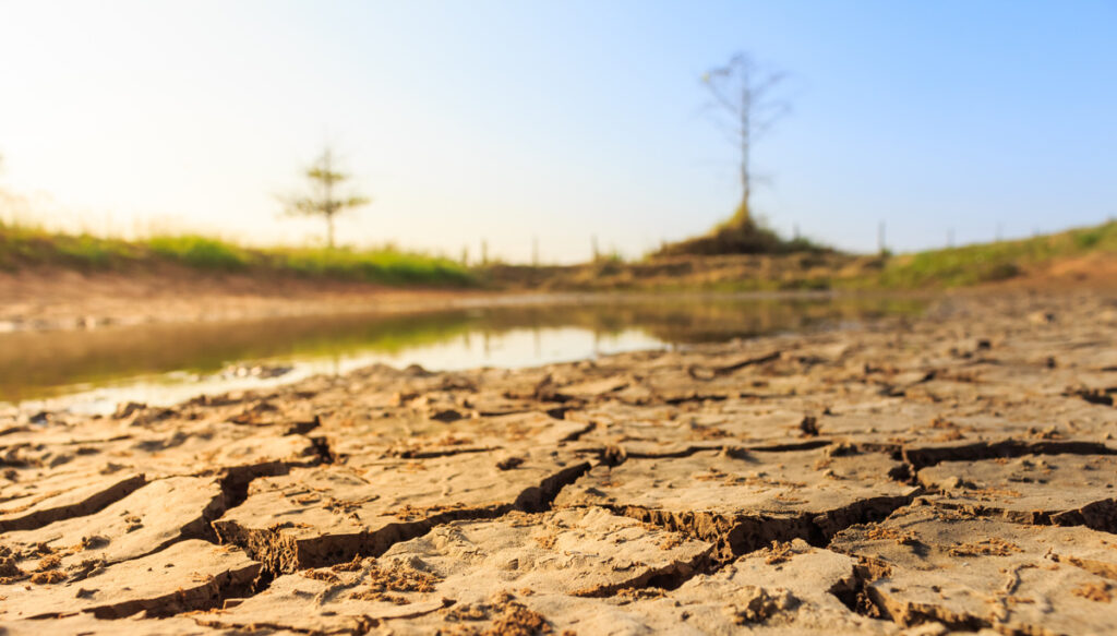
Water security comprises a diverse range of concerns and needs involving the availability, accessibility, and safety of water. Reliable water supplies are critical for domestic consumption and ecosystem health, as well as uses that shape the economy, such as for cooling in power generation, manufacturing, agriculture, and mining.

Recent reports have recognized the significance and implications of water security domestically and on a global scale. Such reports include those written from the U.S. national security perspective [Defense Intelligence Agency, 2012; DOD, 2019], as well as reports by the United Nations [United Nations Educational, Scientific and Cultural Organization, 2019] and the U.S. Agency for International Development [2022]. These reports emphasize the need for comprehensive approaches to address water challenges and ensure the well-being of communities, economies, and ecosystems.
Localized hydrologic and environmental studies play vital roles in understanding the health and dynamics of specific water systems. Meanwhile, innovative technologies like artificial intelligence (AI) and increasingly abundant, diverse, and high-resolution geospatial data offer new opportunities to integrate multiple data sources and employ advanced modeling techniques.
With these tools, researchers can enhance the relevance of local findings and extend their applicability to regional and global contexts. For example, precise locations of rainfall-triggered landslide events, regardless of size, impact, or location, are being leveraged for the nowcasting found in NASA’s Global Landslide Hazard Assessment Model [Stanley et al., 2021].
The ability to scale models down to apply in regions where limited field data are available or to scale them up to broader system scales is particularly valuable for informing national security needs with respect to water. Officials often face the challenge of making critical choices with limited information, so even approximate models with caveats can be useful and provide valuable insights that help guide decisions and policies related to water resources management.
Sustainable Mining for Clean Energy
Mining plays a vital role in society, providing the natural resources essential to make all manner of products and technologies we use daily. “If it wasn’t grown, it’s been mined,” as the saying goes. With the ongoing transition toward a low-carbon energy future, domestic and global demand for minerals such as copper, cobalt, lithium, and rare earth elements is significantly increasing for use in technologies including electric vehicles, solar panels, wind turbines, and batteries.

However, supply chains for many of the minerals critical to this transition are vulnerable, often because of geopolitical tensions or instabilities where the materials are sourced. For example, 15%–20% of global mineral production comes from artisanal and small-scale mining (ASM) [Fritz et al., 2017], and proceeds from ASM can rival or exceed those from large-scale mining in many countries.
Finding economically viable alternative supplies of natural resources and establishing sustainable global supply chains with environmental and humanitarian oversight are crucial for mitigating illicit trade.
ASM involves individuals or groups of miners using simple tools and often operating under unsafe, unregulated, or illegal circumstances. More than 40 million people worldwide directly engage in ASM, largely as a poverty-driven subsistence livelihood [Fritz et al., 2017]. Even more depend on or are affected by ASM indirectly through various economic activities, such as mineral transport, food preparation, and light manufacturing. These economic activities also include illegal operations like prostitution and human and narcotics trafficking that are often tied to illegal financing of mining sites by criminal organizations.
ASM’s dispersed nature and the fact that operations are sometimes located in areas beyond government control create challenges for its regulation. These traits also create opportunities for transnational criminal organizations, violent extremist organizations, and private military contractors to exploit the informal minerals trade (and its workers) for financing or for evading economic sanctions. Finding economically viable alternative supplies of natural resources and establishing sustainable global supply chains with environmental and humanitarian oversight are crucial for mitigating illicit trade.
The geoscience community can contribute by working to identify resources and develop technologies to extract and recycle minerals economically while minimizing environmental impacts, especially in sensitive regions such as rapidly changing coastal areas and the Arctic. The CAC can serve as a bridge to help connect the relevant partners together.
The Changing Arctic
The Arctic is the most rapidly changing geographic region on Earth—with average temperatures rising faster than in the rest of the world [Rantanen et al., 2022]—and a bellwether for environmental change elsewhere. Understanding Arctic change and its implications for national security is thus crucial. Since the United States became an Arctic nation in 1867 with its purchase of Alaska, academic and federal civilian scientists have extensively studied Arctic biology, ecology, geology, glaciology, meteorology, and ethnography to comprehend the unique resources and characteristics of Alaska’s Arctic and subarctic regions.
Military activity around the Aleutians Islands during World War II added national and environmental security dimensions to Arctic research, prompting investigations into permafrost dynamics, sea ice behavior, and operating in extreme Arctic conditions. The 1984 Arctic Research and Policy Act established a national policy and plan for Arctic scientific research that encompasses “natural resources and materials, physical, biological, and health sciences, and social and behavioral sciences.” And the National Science Foundation–chaired Interagency Arctic Research Policy Committee, created by the 1984 legislation, plays a central role in coordinating research efforts of academic scientists and more than a dozen federal agencies that conduct Arctic studies.
On the geopolitical stage, the U.S. Department of State oversees the country’s interactions with the intergovernmental Arctic Council, which was established in 1996. The council promotes cooperation and coordination among the eight Arctic states, Arctic Indigenous peoples, and other Arctic inhabitants on common issues—in particular, issues of sustainable development and environmental protection.

The geoscience community has critical contributions to make to understanding the consequences of the changing Arctic climate for resource development and for other safety and security concerns.
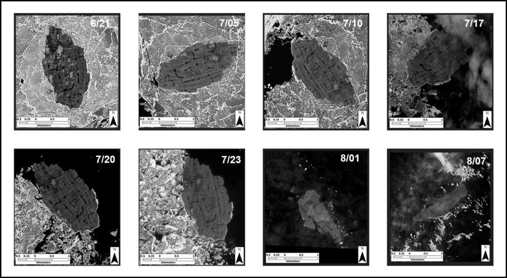
The GFP has focused on studying Arctic sea ice dynamics [Molnia and Wilson, 2023], permafrost degradation, and glacier behavior since the end of the Little Ice Age. Meanwhile, the U.S. intelligence community and the DOD prioritize Arctic domain awareness, which involves navigation safety, search and rescue operations, disaster response, and national security concerns arising from competing claims to resources that are newly accessible as a result of climate change.
The geoscience community has critical contributions to make to understanding the consequences of the changing Arctic climate for resource development in the region and for other safety and security concerns. These contributions include conducting studies to help stakeholders in the region monitor and respond to marine and terrestrial pollution, map safe transportation routes, conserve wildlife and plant species, and respond to emergencies.
Replacing “Over the Transom” with “Over a Bridge”
Policymakers heavily depend on peer-reviewed research to inform their decisions on issues of water security, mineral supply chains, the Arctic, and more. But they often struggle to incorporate scientific findings effectively because of their limited domain knowledge to apply technical concepts at the spatial and temporal scales needed for policy that intersects the geosciences.
The academic community typically focuses its research on areas where data collection and fieldwork are most feasible and for which funding is readily available. However, working solely in those areas may result in data sparsity and geographical blind spots elsewhere. Such blind spots could lead to national security vulnerabilities arising from a lack of domain awareness and could increase the likelihood of “black swan” events (i.e., events that are not predicted using existing knowledge).
We need to build bridges to facilitate meaningful collaboration among the scientific community, national security agencies, and policymakers.
We need to build bridges to facilitate meaningful collaboration and opportunities for regular exchanges of information, education, and dialogue among the scientific community, national security agencies, and policymakers. By improving communication, valuing quality research, and considering the needs of decisionmakers and scientists alike, it is possible to ensure that the best available—and most needed—science is accessible and used to enhance national security.
The difficult next step is determining how to build the needed bridges. Part of this difficulty arises because of challenges to cross-community collaboration. For example, the traditional openness of U.S. academic researchers to engaging with foreign counterparts, whether through universities or state-sponsored agencies, can cause concern in the national security community. There are security risks (e.g., exposure, leaks, or theft of sensitive or proprietary information, as well as commercial or industrial espionage) when scientists are developing and providing technology, methods, and data to collaborators in nations whose governments do not share the same views on intellectual property or geopolitical boundaries as the U.S. government.
Conversely, U.S. academics are concerned about directly collaborating with the national security community. Such collaborations may limit access and cooperation for research conducted outside of the United States. Historically, national security agencies have used access to security clearances and permission to travel abroad to constrain how academic scientists have spoken publicly about politics and international affairs [Wang, 2000]. And for scientists who have family and friends abroad, there may be real concerns for their safety.
Funding cross-community research collaboration is also a challenge, as few programs are designed to provide academic or civilian scientific institutions with research grants targeting the needs of the national security community. Those that do exist generally limit participation to U.S. citizens or U.S.-based institutions.
Thankfully, there are efforts that may provide blueprints for overcoming challenges and creating meaningful dual-direction communication. The Intelligence Community Environmental Security Working Group (ICESWG), sponsored by the CAC, the National Intelligence University, and the National Intelligence Council Strategic Futures Group, might serve as a model. ICESWG promotes the provision and coordination of environmental security–related intelligence and information among the intelligence, civilian government, and academic communities. For example, ICESWG sponsored a Union session at AGU’s Fall Meeting 2022 to raise awareness in the geoscience community of how topics like climate change and water security are relevant to national security interests.
ICESWG membership is limited to authorized government, military, and contractor personnel. In contrast, the Climate Security Advisory Council has the ability to interact more directly with the geosciences community through its federal civil science members and would be a good step toward fostering further cross-community collaboration.
Another solution might be to institute an ongoing series of workshops in which national security stakeholders share with geoscientists needs for data and information that come from policymakers. In close and regular contact, the different communities could learn to speak each other’s languages and communicate more effectively and to discuss potential research solutions to meet these needs. The result could be sustained, intentional, and valuable dialogue to replace the former over-the-transom approach.
Acknowledgments
The views expressed by the authors do not reflect the views of the National Geospatial-Intelligence Agency but do represent the views of the U.S. Geological Survey.
References
Baker, D. J., and L. Zall (2020), The MEDEA program: Opening a window into new Earth science data, Oceanography, 33(1), 20–31, https://doi.org/10.5670/oceanog.2020.104.
Defense Intelligence Agency (2012), Global Water Security: Intelligence Community Assessment, Washington, D.C., www.globalwaters.org/sites/default/files/DNI%20-%20Global%20Water%20Security%20Intelligence%20Community%20Assessment%202012.pdf.
Department of Defense (DOD) (2019), Improving water security and efficiency on installations, Rep. Congr. F-E3F49B7, Washington, D.C., www.acq.osd.mil/eie/Downloads/Congress/Water%20Security%20and%20Efficiency%20Report%20to%20Congress-Report%20Only-2019.pdf.
Fisher, G. B., et al. (2023), Using Global Fiducials Library high-resolution imagery, commercial satellite imagery, Landsat and Sentinel satellite imagery, and aerial photography to monitor change at East Timbalier Island, Louisiana, 1953–2021 (ver. 1.1, May 2023), U.S. Geol. Surv. Sci. Invest. Rep., 2022-5107, 61 pp., https://doi.org/10.3133/sir20225107.
Fleming, J. R. (2000), Storms, strikes, and surveillance: The U.S. Army Signal Office, 1861-1891, Hist. Stud. Phys. Biol. Sci., 30(2), 315–332, https://doi.org/10.2307/27757833.
Fritz, M., et al. (2017), Global Trends in Artisanal and Small-Scale Mining (ASM): A Review of Key Numbers and Issues, Int. Inst. for Sustainable Dev., Winnipeg, Manit., Canada, www.iisd.org/system/files/publications/igf-asm-global-trends.pdf.
Leith, W., and J. R. Matzko (1998), Recent activities in military geology at the U.S. Geological Survey, in Military Geology in War and Peace, Rev. Eng. Geol., 13, 139–143, https://doi.org/10.1130/REG13-p139.
Molnia, B. F., and E. M. Wilson (2023), Documenting Arctic sea ice dynamics with Global Fiducials Program imagery, U.S. Geol. Surv. Open File Rep., 2023-1008, https://doi.org/10.3133/ofr20231008.
Rantanen, M., et al. (2022), The Arctic has warmed nearly four times faster than the globe since 1979, Commun. Earth Environ., 3, 168, https://doi.org/10.1038/s43247-022-00498-3.
Stanley, T. A., et al. (2021), Data-driven landslide nowcasting at the global scale, Front. Earth Sci., 9, 640043, https://doi.org/10.3389/feart.2021.640043.
United Nations Educational, Scientific and Cultural Organization (2019), The United Nations World Water Development Report 2019: Leaving No One Behind, Paris, unesdoc.unesco.org/ark:/48223/pf0000367306.locale=fr.
U.S. Agency for International Development (2022), U.S. global water strategy 2022-2027, Washington, D.C., https://www.usaid.gov/sites/default/files/2022-11/US-Global-Water-Strategy-2022.pdf.
Wang, J. (2000), American Science in an Age of Anxiety: Scientists, Anticommunism, and the Cold War, Chapel Hill: University of North Carolina Press.
Author Information
Peter Chirico and Bruce Molnia, U.S. Geological Survey, Reston, Va.; Anthony Nguy-Robertson ([email protected]), National Geospatial-Intelligence Agency, St. Louis, Mo.; and Dan Opstal, U.S. Geological Survey, Reston, Va.

